
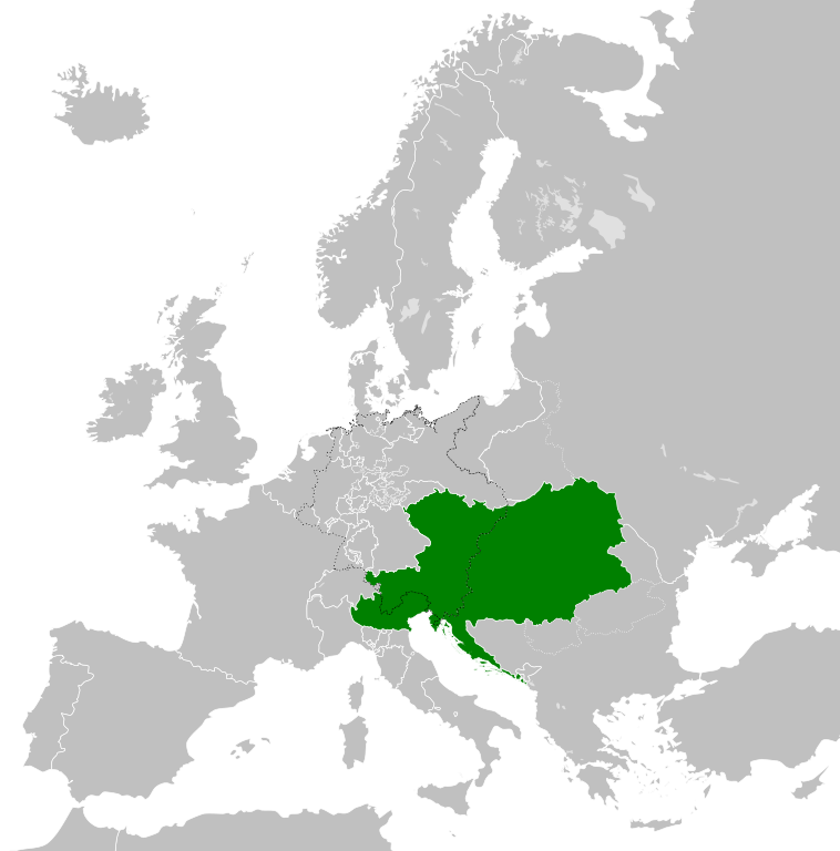
Súbor:Austrian Empire (1815).svg

Veľkosť tohoto PNG náhľadu tohoto SVG súboru: 450 × 456 pixelov. Iné rozlíšenia: 237 × 240 pixelov | 474 × 480 pixelov | 758 × 768 pixelov | 1 011 × 1 024 pixelov | 2 021 × 2 048 pixelov .
Pôvodný súbor (SVG súbor, 450 × 456 pixelov, veľkosť súboru: 691 KB)
Zhrnutie


.svg)
.svg)
.svg)
.svg)
.svg)


.svg)
.svg)
.svg)


.png)
.png)


.svg)


.svg)

.svg)


.svg)
.svg)
.svg)
.svg)


.svg)
.png)


.svg)


.svg)
.svg)


.svg)


.svg)


.svg)
.svg)
.svg)
.svg)
.svg)
.svg)
.svg)
.svg)
_cropped.svg)
.svg)
.svg)
.svg)
.svg)
.svg)
.svg)
.svg)
.svg)
.svg)
.svg)
.svg)
.svg)
.svg)
.svg)
.svg)
.svg)
.svg)
.svg)
.svg)
.svg)
.svg)
.svg)
.svg)
.svg)
.svg)
.svg)
.svg)
.svg)
.svg)
.svg)
.svg)
.svg)
.svg)
.svg)
.svg)
.svg)
.svg)
.svg)
.svg)
.svg)
.svg)
.svg)
.svg)
.svg)
.svg)
História súboru
Po kliknutí na dátum/čas uvidíte ako súbor vyzeral vtedy.
| Dátum/Čas | Náhľad | Rozmery | Používateľ | Komentár | |
|---|---|---|---|---|---|
| aktuálna | 09:58, 16. apríl 2019 | | 450 × 456 (691 KB) | TRAJAN 117 | +++ |
| 21:20, 12. august 2013 |  | 450 × 456 (654 KB) | TRAJAN 117 | Update | |
| 05:47, 12. august 2013 |  | 450 × 456 (1 MB) | TRAJAN 117 | {{Information |Description ={{en|1=The Austrian Empire in 1815.}} |Source ={{own}} {{AttribSVG|Blank map of Europe 1815.svg|Alphathon}} |Author =TRAJAN 117 {{created with Inkscape}} |Date =2013-08-12 |Pe... |
Použitie súboru
Na tento súbor odkazuje nasledujúca stránka:
Globálne využitie súborov
Nasledovné ďalšie wiki používajú tento súbor:
- Použitie na af.wikipedia.org
- Použitie na ast.wikipedia.org
- Použitie na azb.wikipedia.org
- Použitie na ba.wikipedia.org
- Použitie na bg.wikipedia.org
- Použitie na br.wikipedia.org
- Použitie na ce.wikipedia.org
- Použitie na cs.wikipedia.org
- Použitie na cy.wikipedia.org
- Použitie na de.wikipedia.org
- Použitie na el.wikipedia.org
- Použitie na en.wikipedia.org
- Použitie na es.wikipedia.org
- Použitie na fi.wikipedia.org
- Použitie na frr.wikipedia.org
- Použitie na fr.wikipedia.org
- Použitie na ga.wikipedia.org
- Použitie na gd.wikipedia.org
- Použitie na gl.wikipedia.org
- Použitie na he.wikipedia.org
- Použitie na hi.wikipedia.org
- Použitie na hr.wikipedia.org
- Použitie na hy.wikipedia.org
- Použitie na id.wikipedia.org
- Použitie na id.wikibooks.org
- Použitie na incubator.wikimedia.org
- Použitie na is.wikipedia.org
- Použitie na it.wikipedia.org
- Použitie na jam.wikipedia.org
- Použitie na ja.wikipedia.org
- Použitie na ka.wikipedia.org
- Použitie na km.wikipedia.org
- Použitie na ko.wikipedia.org
- Použitie na ky.wikipedia.org
- Použitie na lmo.wikipedia.org
- Použitie na lt.wikipedia.org
- Použitie na lv.wikipedia.org
- Použitie na mk.wikipedia.org
- Použitie na mn.wikipedia.org
- Použitie na nap.wikipedia.org
- Použitie na nl.wikipedia.org
Zobraziť ďalšie globálne použitie tohto súboru.
.svg)
.svg)