
Súbor:Chièvres Hainaut Belgium Map.png
Nie je dostupné vyššie rozlíšenie.
Chièvres_Hainaut_Belgium_Map.png (355 × 278 pixelov, veľkosť súboru: 8 KB, MIME typ: image/png)

|
K tomuto obrázku existuje vektorová verzia (v SVG).
Ak je lepšia, používajte radšej tú. File:Chièvres Hainaut Belgium Map.png → File:Chièvres Hainaut Belgium Map.svg
Podrobnejšie informácie o vektorovej grafike nájdete na stránke Commons:Transition to SVG. Taktiež si môžete prečítať informácie o podpore formátu SVG v MediaWiki. |
 |
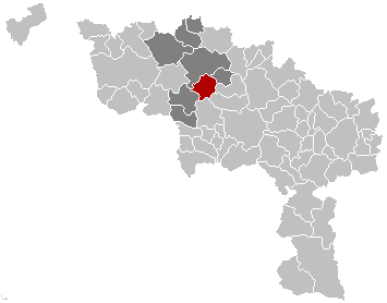
English: Map, municipality belgium Chièvres
Français : Carte indiquant la localisation de la commune de Chièvres dans la Province de Hainaut.
English: Map from w:nl:Gebruiker:LennartBolks/kaartenhoekje in Public Domain by the Author choice.
| Toto dielo uvoľnil ako voľné dielo (public domain) jeho autor, LennartBolks. Toto platí celosvetovo. V niektorých krajinách to zákon neumožňuje; v tom prípade: |
História súboru
Po kliknutí na dátum/čas uvidíte ako súbor vyzeral vtedy.
| Dátum/Čas | Náhľad | Rozmery | Používateľ | Komentár | |
|---|---|---|---|---|---|
| aktuálna | 13:12, 16. november 2008 | | 355 × 278 (8 KB) | Wester | {{Information |Description= |Source= |Date= |Author= |Permission= |other_versions= }} |
| 17:34, 25. máj 2006 |  | 355 × 278 (8 KB) | Profoss | ||
| 21:36, 28. marec 2005 |  | 355 × 278 (6 KB) | Nicnac25~commonswiki | Map, municipality belgium Chièvres {{PD}} FR; Carte indiquant la localisation de la commune de Chièvres dans la Province de Hainaut. EN; Map from w:nl:Gebruiker:LennartBolks/kaartenhoekje in Public Domain by the Author choice. [[Category:Maps of pr |
Použitie súboru
Žiadne stránky neobsahujú odkazy na tento súbor.