
Súbor:Colombia relief location map.jpg

Veľkosť tohto náhľadu: 530 × 600 pixelov. Iné rozlíšenia: 212 × 240 pixelov | 424 × 480 pixelov | 679 × 768 pixelov | 905 × 1 024 pixelov | 2 028 × 2 294 pixelov .
Pôvodný súbor (2 028 × 2 294 pixelov, veľkosť súboru: 1,1 MB, MIME typ: image/jpeg)
Zhrnutie


.svg)


|
Tato mapa byla vytvořena nebo vylepšena v německé Kartenwerkstatt (Mapová laboratoř). Můžete také navrhnout mapy k vylepšení.
|
Licencovanie
Ja, držiteľ autorských práv k tomuto dielu ho týmto zverejňujem za podmienok nasledovnej licencie:
Tento súbor podlieha licencii Creative Commons Attribution-Share Alike 3.0 Unported
- Môžete slobodne:
- zdieľať – kopírovať, šíriť a prenášať dielo
- meniť ho – upravovať dielo
- Za nasledovných podmienok:
- uvedenie autorov – Musíte spomenúť autorov (jednotlivo alebo kolektívne), poskytnúť odkaz na licenciu a uviesť, či ste niečo zmenili. Môžete to urobiť ľubovoľným primeraným spôsobom, ale nie spôsobom naznačujúcim, že poskytovateľ licencie podporuje vás alebo vaše použitie diela.
- meniť za rovnakých podmienok – Ak toto dielo zmeníte, prevediete do inej formy alebo použijete ako základ iného diela, musíte výsledok šíriť pod rovnakou alebo kompatibilnou licenciou ako originál.
História súboru
Po kliknutí na dátum/čas uvidíte ako súbor vyzeral vtedy.
| Dátum/Čas | Náhľad | Rozmery | Používateľ | Komentár | |
|---|---|---|---|---|---|
| aktuálna | 06:53, 16. február 2015 | | 2 028 × 2 294 (1,1 MB) | Milenioscuro | same dimensions of locator map.svg |
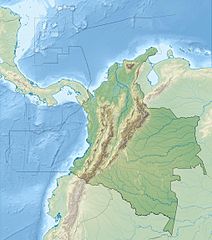
| 12:38, 6. február 2010 |  | 1 516 × 1 736 (901 KB) | Alexrk2 | {{Information |Description= {{de|Physische Positionskarte von Kolumbien Quadratische Plattkarte. Geographische Begrenzung der Karte:}} {{en|Physical Location map of Colombia Equirectangular projection. Geographic limits |
Použitie súboru
Na tento súbor odkazuje nasledujúcich 6 stránok:
Globálne využitie súborov
Nasledovné ďalšie wiki používajú tento súbor:
- Použitie na als.wikipedia.org
- Použitie na ar.wikipedia.org
- Použitie na ast.wikipedia.org
- Použitie na avk.wikipedia.org
- Použitie na azb.wikipedia.org
- Použitie na az.wikipedia.org
- Použitie na ban.wikipedia.org
- Použitie na ba.wikipedia.org
- Použitie na be.wikipedia.org
- Použitie na bg.wikipedia.org
Zobraziť ďalšie globálne použitie tohto súboru.