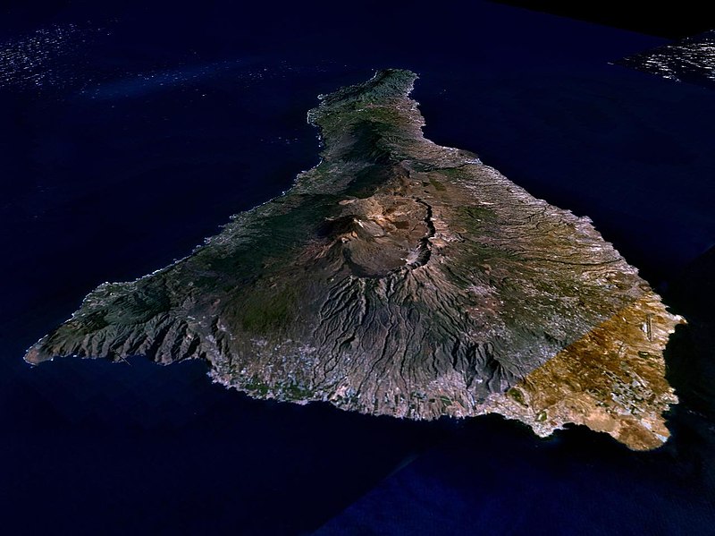
Súbor:Nasa world wind - teneriffa.jpg

Veľkosť tohto náhľadu: 800 × 599 pixelov. Iné rozlíšenia: 320 × 240 pixelov | 640 × 479 pixelov | 1 024 × 766 pixelov | 1 280 × 958 pixelov .
Pôvodný súbor (1 280 × 958 pixelov, veľkosť súboru: 120 KB, MIME typ: image/jpeg)
História súboru
Po kliknutí na dátum/čas uvidíte ako súbor vyzeral vtedy.
| Dátum/Čas | Náhľad | Rozmery | Používateľ | Komentár | |
|---|---|---|---|---|---|
| aktuálna | 01:15, 31. marec 2005 |  | 1 280 × 958 (120 KB) | Simplicius | {{NASA-PD}} Teneriffa from the west side. One sees Teide (3,700 meters) and the Caldera (2,000 m). To the right hand the new airport. On the left side one sees that there is more humidity and therefore vegetation at the north side of the island. |
Použitie súboru
Globálne využitie súborov
Nasledovné ďalšie wiki používajú tento súbor:
- Použitie na ar.wikipedia.org
- Použitie na be-tarask.wikipedia.org
- Použitie na cs.wikipedia.org
- Použitie na de.wikipedia.org
- Použitie na de.wikinews.org
- Použitie na de.wikivoyage.org
- Použitie na en.wiktionary.org
- Použitie na eo.wikipedia.org
- Použitie na es.wikipedia.org
- Použitie na fa.wikipedia.org
- Použitie na fi.wikipedia.org
- Použitie na frr.wikipedia.org
- Použitie na fy.wikipedia.org
- Použitie na gl.wikipedia.org
- Použitie na he.wikipedia.org
- Použitie na hu.wikipedia.org
- Použitie na incubator.wikimedia.org
- Použitie na it.wikipedia.org
- Použitie na mn.wikipedia.org
- Použitie na nn.wikipedia.org
- Použitie na no.wikipedia.org
- Použitie na pl.wiktionary.org
- Použitie na ru.wikipedia.org
- Použitie na sh.wikipedia.org
- Použitie na sw.wikipedia.org
- Použitie na tr.wikipedia.org
- Použitie na uk.wikipedia.org
- Použitie na vi.wikivoyage.org
- Použitie na zgh.wikipedia.org

