
Súbor:British Isles Rockall.svg

Veľkosť tohoto PNG náhľadu tohoto SVG súboru: 447 × 599 pixelov. Iné rozlíšenia: 179 × 240 pixelov | 358 × 480 pixelov | 573 × 768 pixelov | 764 × 1 024 pixelov | 1 527 × 2 048 pixelov | 880 × 1 180 pixelov .
Pôvodný súbor (SVG súbor, 880 × 1 180 pixelov, veľkosť súboru: 138 KB)
Zhrnutie
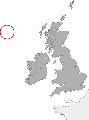
| Popis | map showing the location of Rockall in relation to Great Britain and Ireland |
| Dátum | |
| Zdroj | Vlastné dielo |
| Autor | Cnbrb |
Licencovanie
| Ja, držiteľ autorských práv k tomuto dielu, uvoľňujem toto dielo ako voľné dielo (public domain). Toto platí celosvetovo. V niektorých krajinách to zákon neumožňuje; v tom prípade: Udeľujem komukoľvek právo používať toto dielo na ľubovoľné účely, bez akýchkoľvek podmienok ak také podmienky nevyžaduje zákon. |
História súboru
Po kliknutí na dátum/čas uvidíte ako súbor vyzeral vtedy.
| Dátum/Čas | Náhľad | Rozmery | Používateľ | Komentár | |
|---|---|---|---|---|---|
| aktuálna | 02:06, 21. október 2007 | | 880 × 1 180 (138 KB) | Cnbrb | == Summary == {{Information |Description=map showing the location of Rockall in relation to Great Britain and Ireland |Source=self-made |Date=2007-21-09 |Author= Cnbrb }} Category:Locator maps of countries of the United Kingdom [[Categ |
| 01:55, 21. október 2007 |  | 1 175 × 1 180 (137 KB) | Cnbrb | == Summary == {{Information |Description=map showing the location of Rockall in relation to Great Britain and Ireland |Source=self-made |Date=2007-21-09 |Author= Cnbrb }} Category:Locator maps of countries of the United Kingdom [[Categ |
Použitie súboru
Na tento súbor odkazuje nasledujúca stránka:
Globálne využitie súborov
Nasledovné ďalšie wiki používajú tento súbor:
- Použitie na it.wikipedia.org
- Použitie na ja.wikipedia.org
- Použitie na zh.wikipedia.org