
Súbor:EnglandNorfolk.png
Nie je dostupné vyššie rozlíšenie.
EnglandNorfolk.png (200 × 247 pixelov, veľkosť súboru: 26 KB, MIME typ: image/png)
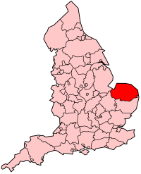
From en:Image:EnglandNorfolk.png map of admin county

|
Bolo udelené povolenie kopírovať, širiť a/alebo meniť tento dokument za podmienok GNU Free Documentation License, verzie 1.2 alebo ktorejkoľvek neskoršej verzie publikovanej Free Software Foundation; bez Nemenných častí, bez Textov na prednej obálke a bez Textov na zadnej obálke. Kópia tejto licencie je zahrnutá v časti nazvanej GNU Free Documentation License. |
| Tento súbor podlieha licencii Creative Commons Attribution-Share Alike 3.0 Unported | ||
| ||
| Táto šablóna licencie bola pridaná k tomuto súboru počas aktualizácie licencovania GFDL. |
História súboru
Po kliknutí na dátum/čas uvidíte ako súbor vyzeral vtedy.
| Dátum/Čas | Náhľad | Rozmery | Používateľ | Komentár | |
|---|---|---|---|---|---|
| aktuálna | 14:00, 19. jún 2005 | | 200 × 247 (26 KB) | Airunp | From en:Image:EnglandNorfolk.png map of admin county {{GFDL}} en:Norfolk es:Norfolk Category:Maps of Great Britain |
Použitie súboru
Na tento súbor odkazuje nasledujúca stránka:
Globálne využitie súborov
Nasledovné ďalšie wiki používajú tento súbor:
- Použitie na af.wikipedia.org
- Použitie na be.wikipedia.org
- Použitie na cs.wikipedia.org
- Použitie na cv.wikipedia.org
- Použitie na cy.wikipedia.org
- Použitie na da.wikipedia.org
- Použitie na de.wikipedia.org
- Použitie na en.wikipedia.org
- User:Morwen/Allcounties
- Cromer Tunnel
- Aylsham Bypass Tunnel
- Category:Schools in Norfolk
- Bloodgate Hill Iron Age Fort
- Bedingham
- Bromholm Priory
- Category:Wikipedia requested photographs in Norfolk
- Shelton Hall (Norfolk)
- Church of St Margaret, Breckles
- Mutton's Mill
- Lambridge Mill
- Moulton St Mary
- Pulls Ferry, Norwich
- Manor Farm, Pulham Market
- Template:Norfolk-struct-stub
- County Ground, Lakenham
- Norwich Bus Station
- Category:Private schools in Norfolk
- Letton Hall
- Clayrack Drainage Mill
- Palmer's Drainage Windmill
- North Norfolk District Council Headquarters
- Blakeney Windmill
- Starston Windpump
- Stubb Drainage Windmill
- St. Edmund's Chapel, Lyng
- List of schools in Norfolk
- Bewilderwood
- Somerleyton Swing Bridge
- Norfolk Nelson Museum
- Gissing Hall
- Windham Manor
- Shropham Hall
- Blackborough Priory
- Coxford Priory
- Crabhouse Priory
- Docking Priory
- Flitcham Priory
- Hickling Priory
- Horsham St. Faith Priory
- Horstead Priory
Zobraziť ďalšie globálne použitie tohto súboru.