
Súbor:Island of Ireland location map Down.svg

Veľkosť tohoto PNG náhľadu tohoto SVG súboru: 796 × 599 pixelov. Iné rozlíšenia: 319 × 240 pixelov | 638 × 480 pixelov | 1 020 × 768 pixelov | 1 280 × 964 pixelov | 2 560 × 1 928 pixelov | 931 × 701 pixelov .
Pôvodný súbor (SVG súbor, 931 × 701 pixelov, veľkosť súboru: 826 KB)
| Popis |
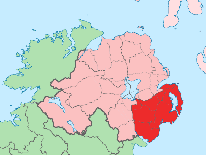
English: The island of Ireland, showing international border between Ireland and Northern Ireland, traditional provinces, traditional counties, and local authority areas in Ireland and Northern Ireland. |
| Dátum | (UTC) |
| Zdroj | |
| Autor |
|
| Toto je upravený obrázek, což znamená, že byl oproti původní verzi digitálně změněn. Úpravy: Added colours for specific county. Původní verzi je možné zhlédnout zde: Island of Ireland location map.svg. Úpravy provedl Mabuska.
|
Ja, držiteľ autorských práv k tomuto dielu ho týmto zverejňujem za podmienok nasledovnej licencie:
Tento súbor podlieha licencii Creative Commons Attribution-Share Alike 3.0 Unported
- Môžete slobodne:
- zdieľať – kopírovať, šíriť a prenášať dielo
- meniť ho – upravovať dielo
- Za nasledovných podmienok:
- uvedenie autorov – Musíte spomenúť autorov (jednotlivo alebo kolektívne), poskytnúť odkaz na licenciu a uviesť, či ste niečo zmenili. Môžete to urobiť ľubovoľným primeraným spôsobom, ale nie spôsobom naznačujúcim, že poskytovateľ licencie podporuje vás alebo vaše použitie diela.
- meniť za rovnakých podmienok – Ak toto dielo zmeníte, prevediete do inej formy alebo použijete ako základ iného diela, musíte výsledok šíriť pod rovnakou alebo kompatibilnou licenciou ako originál.
Pôvodný záznam nahrávaní
This image is a derivative work of the following images:
- File:Island_of_Ireland_location_map.svg licensed with Cc-by-sa-3.0
- 2010-03-06T20:43:33Z Rannpháirtí anaithnid 1450x1807 (679207 Bytes) Fix incorrectly coloured isands.
- 2010-03-03T22:19:29Z Rannpháirtí anaithnid 1450x1807 (679744 Bytes) {{Information |Description={{de|Positionskarte von [[:de:Irland|Irland]]}} Quadratische Plattkarte, N-S-Streckung 170 %. Geographische Begrenzung der Karte: * N: 55.6° N * S: 51.2° N * W: 11.0° W * O: 5.0° W {{en|Location
Uploaded with derivativeFX
História súboru
Po kliknutí na dátum/čas uvidíte ako súbor vyzeral vtedy.
| Dátum/Čas | Náhľad | Rozmery | Používateľ | Komentár | |
|---|---|---|---|---|---|
| aktuálna | 13:02, 19. júl 2010 | | 931 × 701 (826 KB) | Mabuska | fixed scotland boundary |
| 11:45, 19. júl 2010 |  | 934 × 717 (828 KB) | Mabuska | {{Information |Description={{en|The island of Ireland, showing international border between Northern Ireland and Republic of Ireland, traditional provinces, traditional counties, and local authority areas in the Republic of Ireland and Northern Ireland.}} |
Použitie súboru
Na tento súbor odkazuje nasledujúca stránka:
Globálne využitie súborov
Nasledovné ďalšie wiki používajú tento súbor:
- Použitie na ar.wikipedia.org
- Použitie na ast.wikipedia.org
- Použitie na bg.wikipedia.org
- Použitie na ca.wikipedia.org
- Použitie na cs.wikipedia.org
- Použitie na de.wikipedia.org
- Použitie na en.wikipedia.org
- Použitie na eo.wikipedia.org
- Použitie na es.wikipedia.org
- Použitie na eu.wikipedia.org
- Belfast
- Newry
- Lisburn
- Bangor (Ipar Irlanda)
- Downpatrick
- Lankide:Euskaldunaa
- Newtownards
- Banbridge
- Down konderria
- Txantiloi:Down konderriko udalerriak
- Lurganville
- Ballynahinch (Down konderria)
- Carryduff
- Comber
- Donaghadee
- Dromore (Down konderria)
- Dundonald
- Holywood
- Kilkeel
- Newcastle (Down konderria)
- Warrenpoint
- Annahilt
- Annalong
- Annsborough
- Ardglass
- Atticall
- Aughnacloy (Down konderria)
- Ballela
- Balloo (Down konderria)
- Ballybannan
- Ballybeen
- Ballydargan
- Ballygowan
- Ballyhalbert
- Ballyhay
- Ballyhornan
- Ballykinler
- Ballylesson
- Ballylough
- Ballymacmaine
Zobraziť ďalšie globálne použitie tohto súboru.