
Súbor:Barat Daya Islands de.png

Veľkosť tohto náhľadu: 800 × 548 pixelov. Iné rozlíšenia: 320 × 219 pixelov | 640 × 439 pixelov | 1 024 × 702 pixelov | 1 280 × 878 pixelov | 2 271 × 1 557 pixelov .
Pôvodný súbor (2 271 × 1 557 pixelov, veľkosť súboru: 1,56 MB, MIME typ: image/png)
Zhrnutie
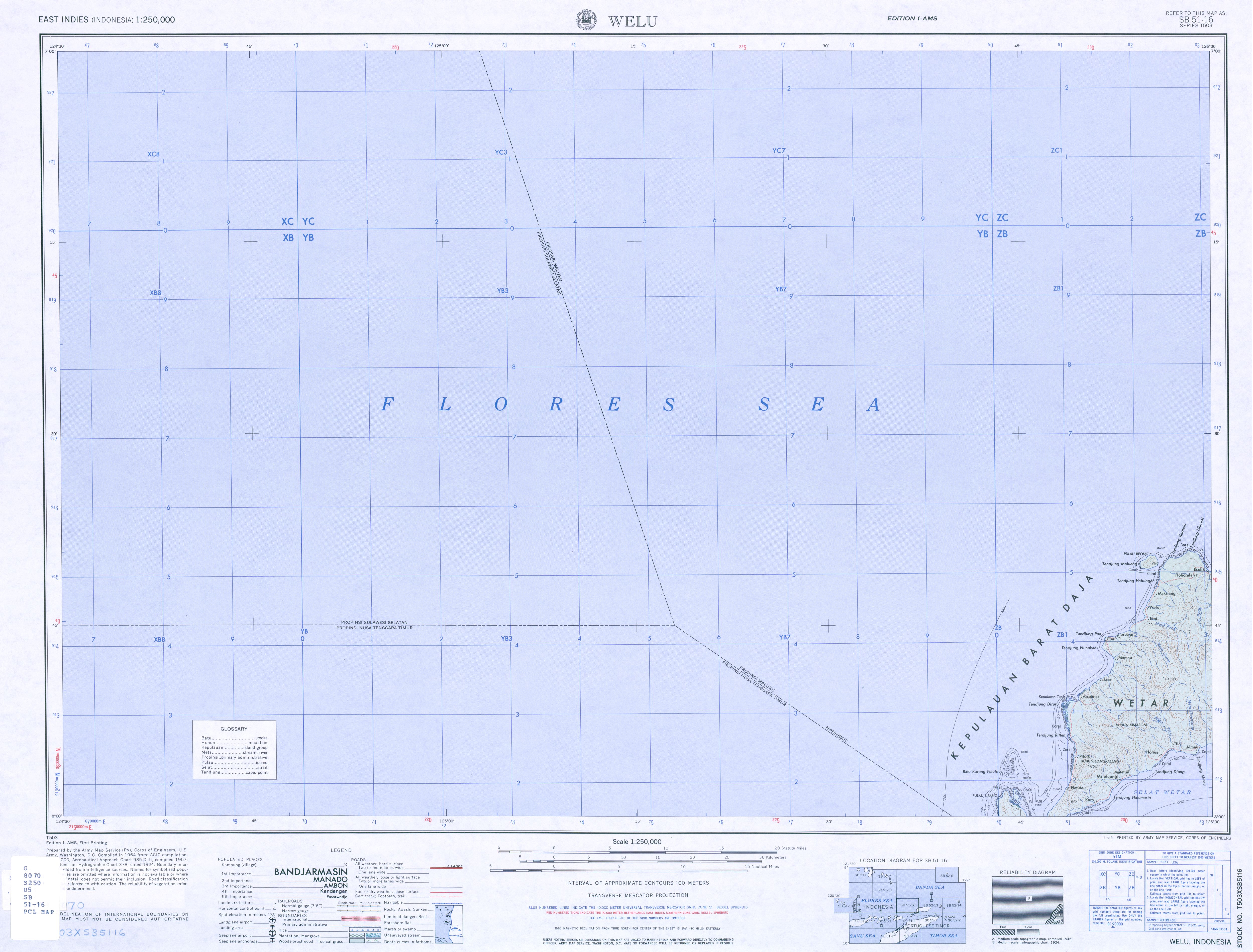
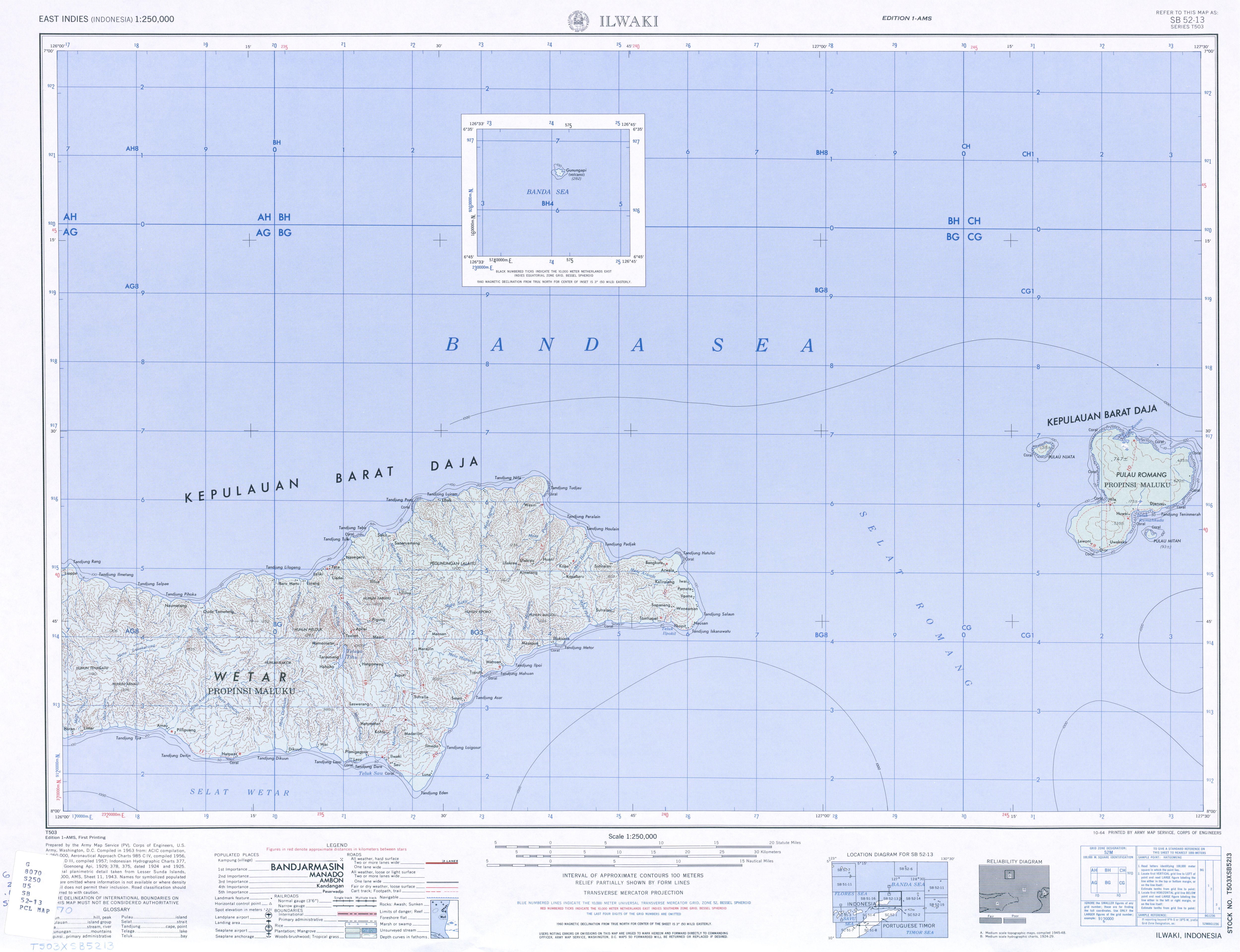
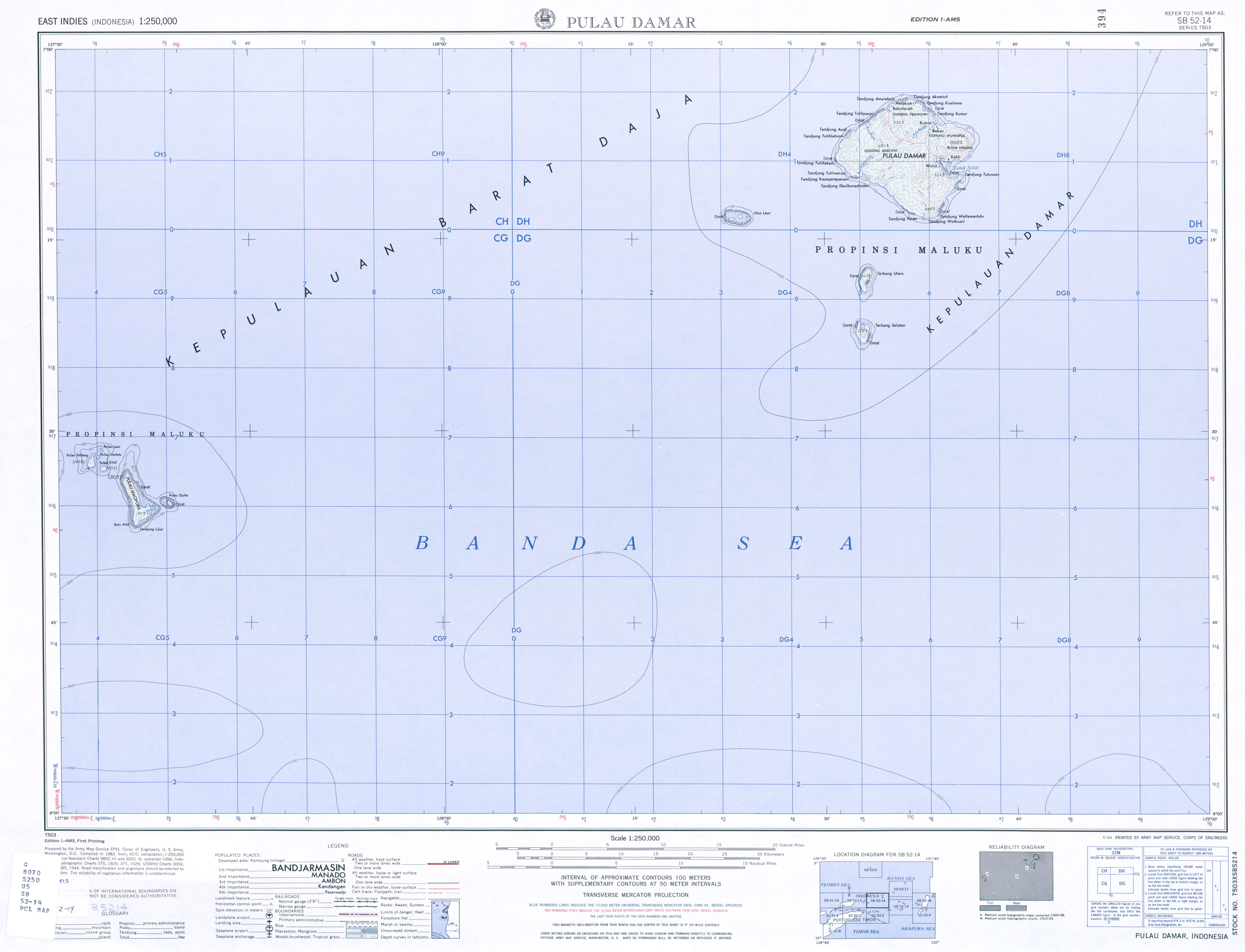
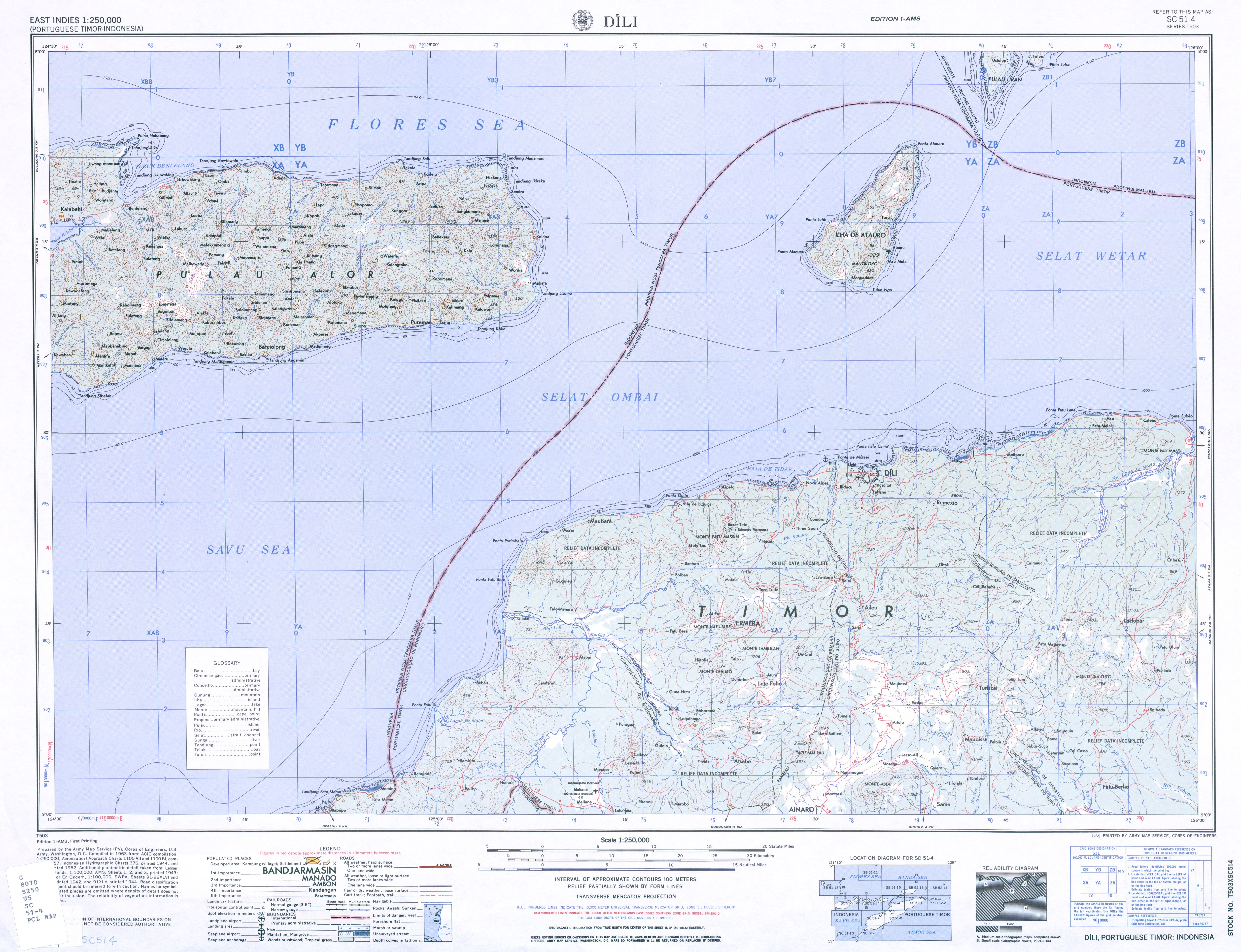
| Popis | |
| Dátum | |
| Zdroj |
own work, used:
|
| Autor | Lencer |
| Ďalšie verzie |
Díla odvozená od tohoto souboru: Romang de.png
|


|
Tato mapa byla vytvořena nebo vylepšena v německé Kartenwerkstatt (Mapová laboratoř). Můžete také navrhnout mapy k vylepšení.
|
Licencovanie
Ja, držiteľ autorských práv k tomuto dielu ho týmto zverejňujem za podmienok nasledovnej licencie:
Tento súbor podlieha licencii Creative Commons Attribution-Share Alike 3.0 Unported
- Môžete slobodne:
- zdieľať – kopírovať, šíriť a prenášať dielo
- meniť ho – upravovať dielo
- Za nasledovných podmienok:
- uvedenie autorov – Musíte spomenúť autorov (jednotlivo alebo kolektívne), poskytnúť odkaz na licenciu a uviesť, či ste niečo zmenili. Môžete to urobiť ľubovoľným primeraným spôsobom, ale nie spôsobom naznačujúcim, že poskytovateľ licencie podporuje vás alebo vaše použitie diela.
- meniť za rovnakých podmienok – Ak toto dielo zmeníte, prevediete do inej formy alebo použijete ako základ iného diela, musíte výsledok šíriť pod rovnakou alebo kompatibilnou licenciou ako originál.
História súboru
Po kliknutí na dátum/čas uvidíte ako súbor vyzeral vtedy.
| Dátum/Čas | Náhľad | Rozmery | Používateľ | Komentár | |
|---|---|---|---|---|---|
| aktuálna | 17:55, 24. marec 2013 | | 2 271 × 1 557 (1,56 MB) | Lencer | some fixes |
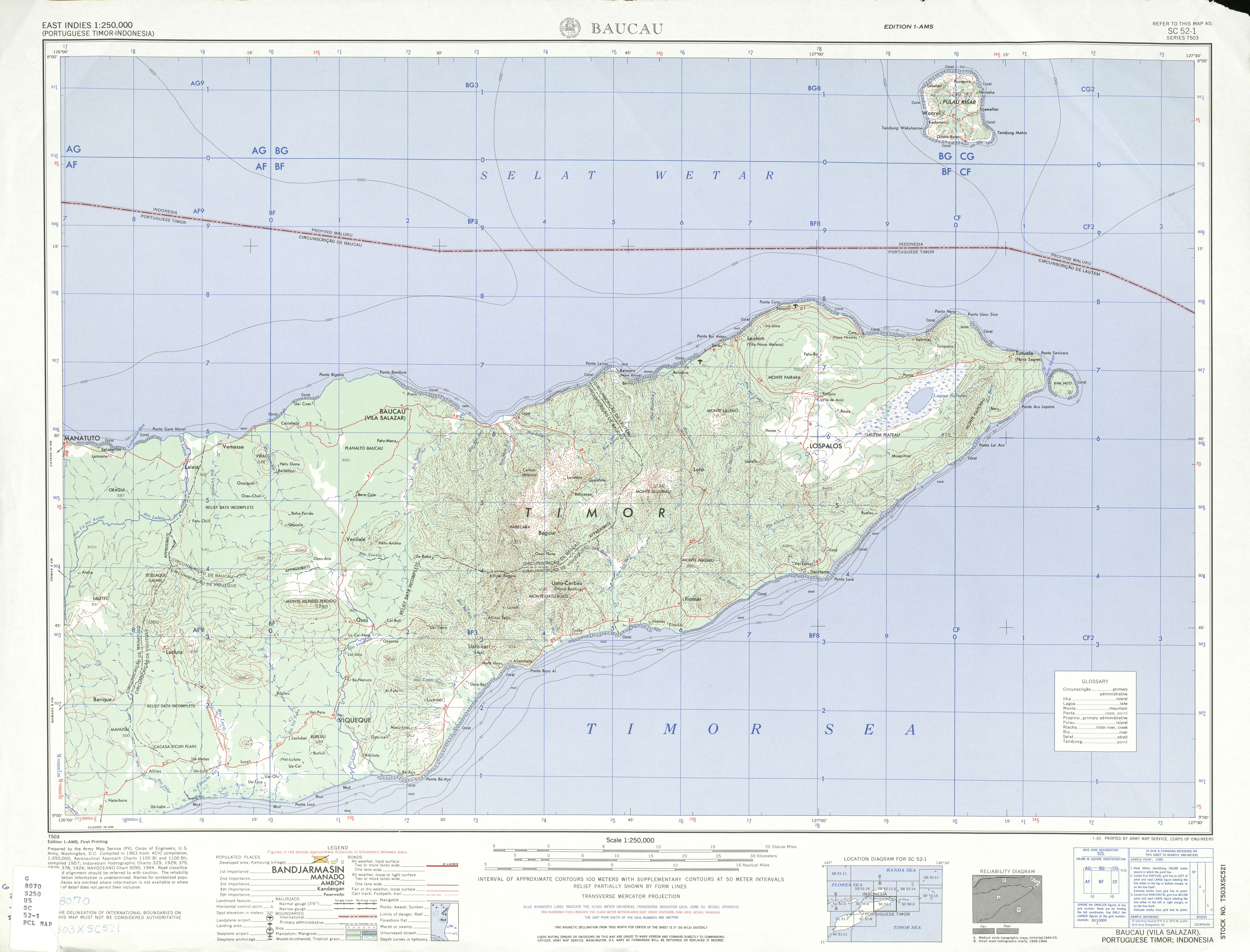
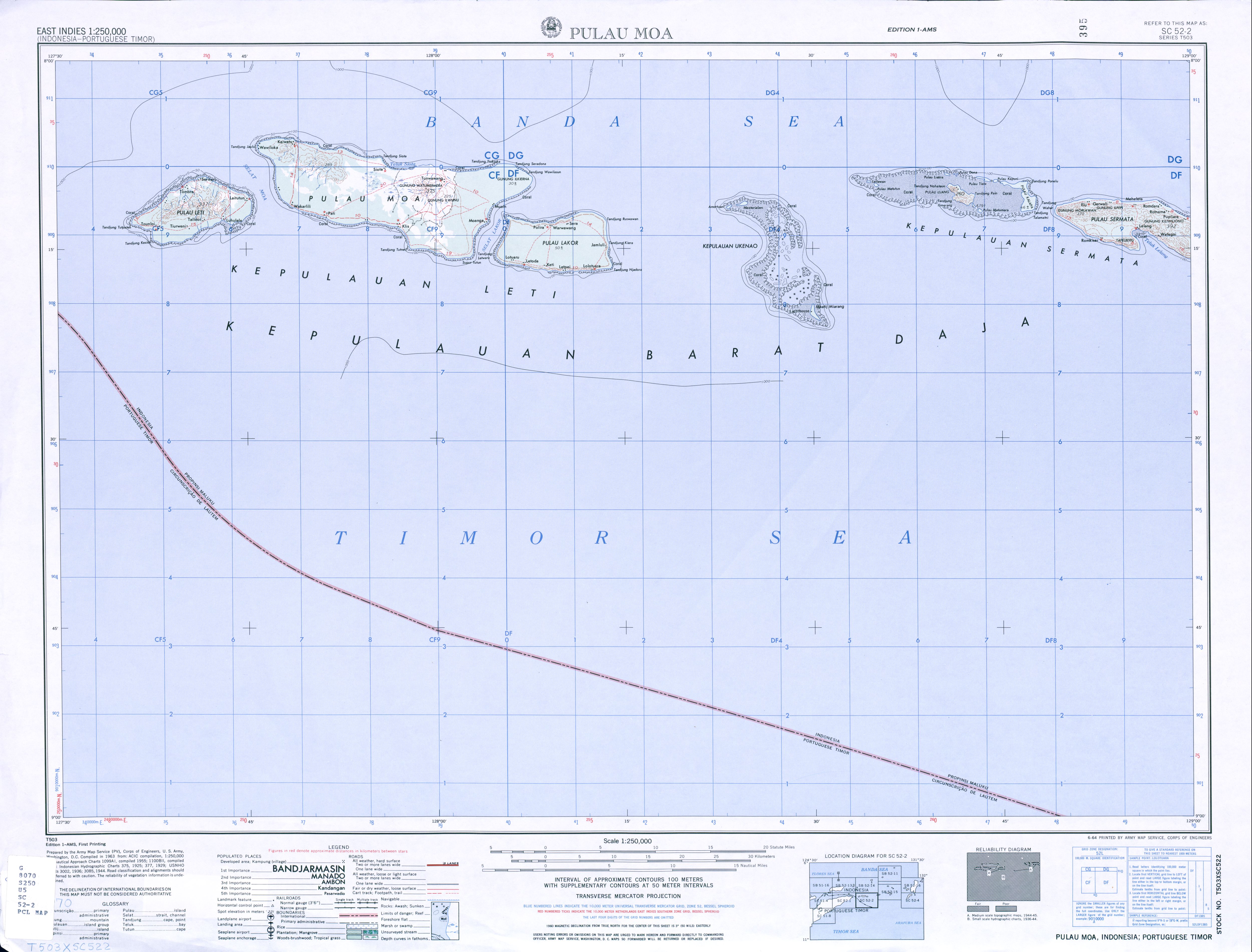
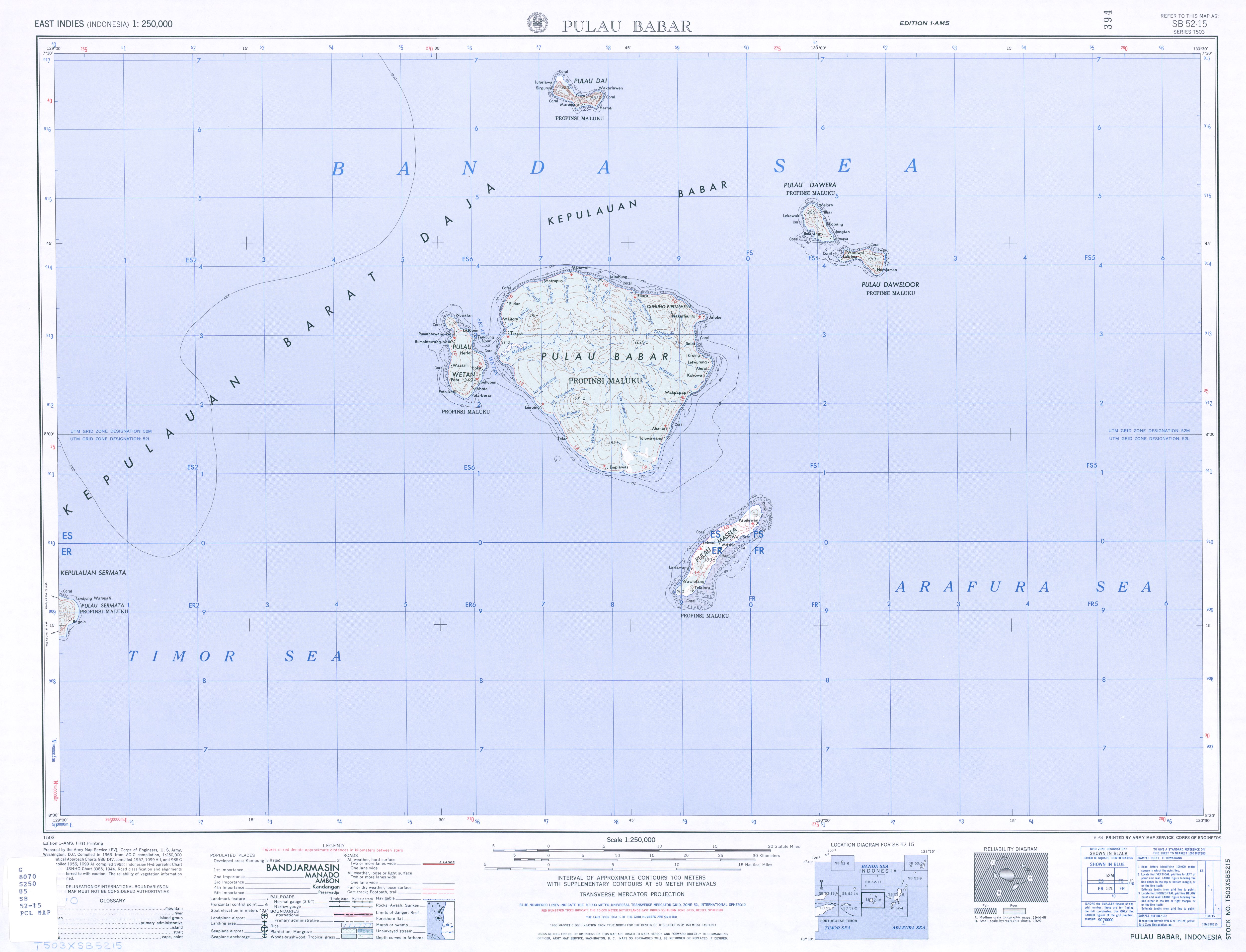
| 15:18, 22. marec 2013 |  | 1 500 × 1 028 (792 KB) | Lencer | == {{int:filedesc}} == {{Information |Description= {{de|Karte der Barat-Daya-Inseln, sowie der Leti-Inseln, Sermata-Inseln und Babar-Inseln. {{en|Map of [[:en:Bar... |
Použitie súboru
Na tento súbor odkazuje nasledujúca stránka:
Globálne využitie súborov
Nasledovné ďalšie wiki používajú tento súbor:
- Použitie na arz.wikipedia.org
- Použitie na ca.wikipedia.org
- Použitie na ceb.wikipedia.org
- Použitie na cs.wikipedia.org
- Použitie na de.wikipedia.org
- Použitie na fr.wikipedia.org
- Použitie na gl.wikipedia.org
- Použitie na it.wikipedia.org
- Použitie na nl.wikipedia.org
- Použitie na pl.wikipedia.org
- Použitie na www.wikidata.org