
Súbor:Doggerland.svg

Veľkosť tohoto PNG náhľadu tohoto SVG súboru: 545 × 600 pixelov. Iné rozlíšenia: 218 × 240 pixelov | 436 × 480 pixelov | 698 × 768 pixelov | 930 × 1 024 pixelov | 1 860 × 2 048 pixelov .
Pôvodný súbor (SVG súbor, 545 × 600 pixelov, veľkosť súboru: 165 KB)
Zhrnutie
| Popis |
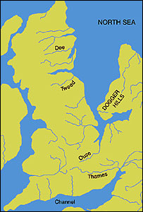
English: An image of the area known as Doggerland which connected the British Isles and the European continent. Loosely based on two images, found at http://www.bevpease.force9.co.uk/p.Flood_files/image002.jpg and http://humanities.exeter.ac.uk/archaeology/research/projects/title_89282_en.html, (now archived at https://web.archive.org/web/20220420042919/http://humanities.exeter.ac.uk/archaeology/research/projects/title_89282_en.html) however drawing work was all done in Illustrator by myself. Norway has been excluded from the map.
Deutsch: Paläogeografische Darstellung der Nordsee vor etwa 9000 Jahren, bevor Doggerland vom Festland getrennt wurde.
|
| Dátum | |
| Zdroj | Vlastné dielo |
| Autor | Max Naylor |
W3C-validity not checked.
Licencovanie
Ja, držiteľ autorských práv k tomuto dielu ho týmto zverejňujem za podmienok nasledovných licencií:
Tento súbor podlieha licencii Creative Commons Attribution-Share Alike 3.0 Unported
- Môžete slobodne:
- zdieľať – kopírovať, šíriť a prenášať dielo
- meniť ho – upravovať dielo
- Za nasledovných podmienok:
- uvedenie autorov – Musíte spomenúť autorov (jednotlivo alebo kolektívne), poskytnúť odkaz na licenciu a uviesť, či ste niečo zmenili. Môžete to urobiť ľubovoľným primeraným spôsobom, ale nie spôsobom naznačujúcim, že poskytovateľ licencie podporuje vás alebo vaše použitie diela.
- meniť za rovnakých podmienok – Ak toto dielo zmeníte, prevediete do inej formy alebo použijete ako základ iného diela, musíte výsledok šíriť pod rovnakou alebo kompatibilnou licenciou ako originál.

|
Bolo udelené povolenie kopírovať, širiť a/alebo meniť tento dokument za podmienok GNU Free Documentation License, verzie 1.2 alebo ktorejkoľvek neskoršej verzie publikovanej Free Software Foundation; bez Nemenných častí, bez Textov na prednej obálke a bez Textov na zadnej obálke. Kópia tejto licencie je zahrnutá v časti nazvanej GNU Free Documentation License. |
Môžete si zvoliť ľubovolnú z týchto licencií.
História súboru
Po kliknutí na dátum/čas uvidíte ako súbor vyzeral vtedy.
| Dátum/Čas | Náhľad | Rozmery | Používateľ | Komentár | |
|---|---|---|---|---|---|
| aktuálna | 18:59, 19. október 2014 | | 545 × 600 (165 KB) | Ras67 | frame removed |
| 13:06, 24. jún 2011 |  | 348 × 383 (132 KB) | Ciaurlec | Changed colours to uniform all the palaeogeographic maps | |
| 00:52, 22. február 2009 |  | 348 × 383 (125 KB) | Maxí | {{Information |Description={{en|1=An image of the area known as Doggerland which connected the British Isles and the European continent. Loosely based on two images, found [http://www.bevpease.force9.co.uk/p.Flood_files/image002.jpg here] and [http://soga |
Použitie súboru
Na tento súbor odkazuje nasledujúca stránka:
Globálne využitie súborov
Nasledovné ďalšie wiki používajú tento súbor:
- Použitie na ar.wikipedia.org
- Použitie na be.wikipedia.org
- Použitie na ca.wikipedia.org
- Použitie na cs.wikipedia.org
- Použitie na cy.wikipedia.org
- Použitie na da.wikipedia.org
- Použitie na de.wikipedia.org
- Použitie na el.wikipedia.org
- Použitie na en.wikipedia.org
- Použitie na eo.wikipedia.org
- Použitie na es.wikipedia.org
- Použitie na et.wikipedia.org
- Použitie na eu.wikipedia.org
- Použitie na fa.wikipedia.org
- Použitie na fi.wikipedia.org
- Použitie na frr.wikipedia.org
- Použitie na fr.wikipedia.org
- Použitie na fr.wiktionary.org
- Použitie na he.wikipedia.org
- Použitie na hr.wikipedia.org
- Použitie na hu.wikipedia.org
- Použitie na hy.wikipedia.org
Zobraziť ďalšie globálne použitie tohto súboru.