
Súbor:Kingdom of France (1815).svg

Veľkosť tohoto PNG náhľadu tohoto SVG súboru: 450 × 456 pixelov. Iné rozlíšenia: 237 × 240 pixelov | 474 × 480 pixelov | 758 × 768 pixelov | 1 011 × 1 024 pixelov | 2 021 × 2 048 pixelov .
Pôvodný súbor (SVG súbor, 450 × 456 pixelov, veľkosť súboru: 691 KB)
Zhrnutie


.svg)
.svg)
.svg)
.svg)
.svg)


.svg)
.svg)
.svg)


.png)
.png)


.svg)


.svg)

.svg)


.svg)
.svg)
.svg)
.svg)


.svg)
.png)


.svg)


.svg)
.svg)


.svg)


.svg)


.svg)
.svg)
.svg)
.svg)
.svg)
.svg)
.svg)
.svg)
_cropped.svg)
.svg)
.svg)
.svg)
.svg)
.svg)
.svg)
.svg)
.svg)
.svg)
.svg)
.svg)
.svg)
.svg)
.svg)
.svg)
.svg)
.svg)
.svg)
.svg)
.svg)
.svg)
.svg)
.svg)
.svg)
.svg)
.svg)
.svg)
.svg)
.svg)
.svg)
.svg)
.svg)
.svg)
.svg)
.svg)
.svg)
.svg)
.svg)
.svg)
.svg)
.svg)
.svg)
.svg)
.svg)
.svg)
História súboru
Po kliknutí na dátum/čas uvidíte ako súbor vyzeral vtedy.
| Dátum/Čas | Náhľad | Rozmery | Používateľ | Komentár | |
|---|---|---|---|---|---|
| aktuálna | 01:57, 25. december 2017 | | 450 × 456 (691 KB) | TRAJAN 117 | +++ |
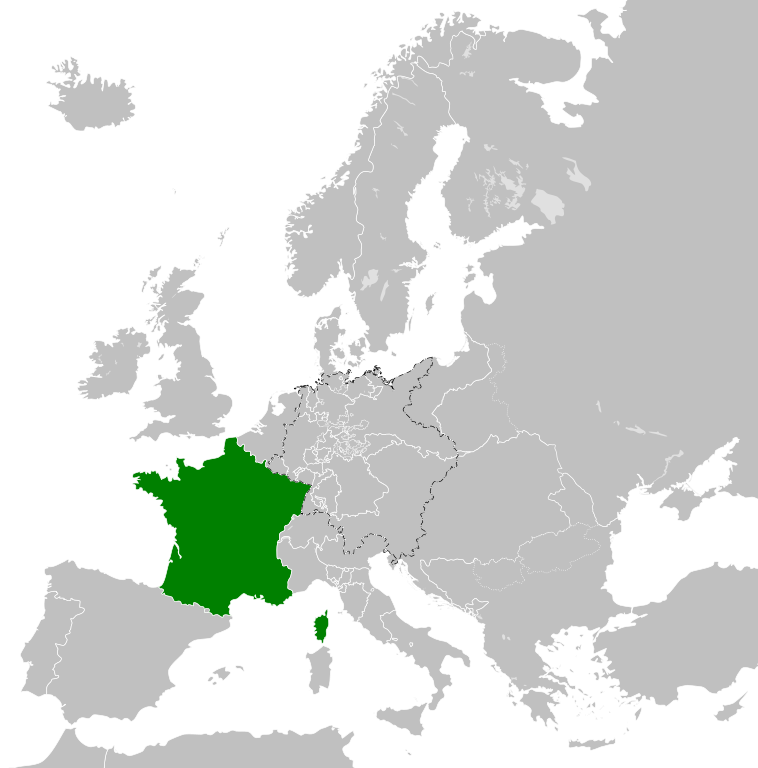
| 21:00, 26. august 2013 |  | 450 × 456 (655 KB) | TRAJAN 117 | {{Information |Description ={{en|1=The Kingdom of France in 1815.}} |Source ={{own}} {{AttribSVG|Blank map of Europe 1815.svg|Alphathon}} |Author =TRAJAN 117 {{created with Inkscape}} |Date =2013-08-26 |... |
Použitie súboru
Na tento súbor odkazuje nasledujúca stránka:
Globálne využitie súborov
Nasledovné ďalšie wiki používajú tento súbor:
- Použitie na ar.wikipedia.org
- Použitie na ast.wikipedia.org
- Použitie na az.wikipedia.org
- Použitie na be.wikipedia.org
- Použitie na bn.wikipedia.org
- Použitie na ca.wikipedia.org
- Použitie na cs.wikipedia.org
- Použitie na da.wikipedia.org
- Použitie na el.wikipedia.org
- Použitie na en.wikipedia.org
- Použitie na eo.wikipedia.org
- Použitie na es.wikipedia.org
- Použitie na fa.wikipedia.org
- Použitie na fi.wikipedia.org
- Použitie na fr.wikipedia.org
- Použitie na gl.wikipedia.org
- Použitie na he.wikipedia.org
- Použitie na hu.wikipedia.org
- Použitie na id.wikipedia.org
- Použitie na it.wikipedia.org
- Použitie na ja.wikipedia.org
- Použitie na ka.wikipedia.org
- Použitie na ko.wikipedia.org
- Použitie na lv.wikipedia.org
- Použitie na mk.wikipedia.org
- Použitie na nl.wikipedia.org
- Použitie na no.wikipedia.org
- Použitie na pl.wikipedia.org
- Použitie na pt.wikipedia.org
- Použitie na ro.wikipedia.org
- Použitie na ru.wikipedia.org
- Použitie na sh.wikipedia.org
- Použitie na simple.wikipedia.org
- Použitie na th.wikipedia.org
- Použitie na uk.wikipedia.org
- Použitie na vi.wikipedia.org
- Použitie na www.wikidata.org
- Použitie na zh.wikipedia.org
.svg)