
Súbor:Nouvelle-France map-fr.svg

Pôvodný súbor (SVG súbor, 1 530 × 1 090 pixelov, veľkosť súboru: 375 KB)
Zhrnutie
| Popis |
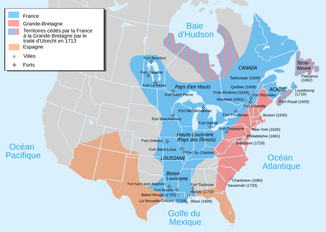
Català: Mapa de la Nova França sobre 1754-1755 English: Map of New France about 1750 using modern political boundaries Español: Mapa de la Nueva Francia cerca de 1750. Français : Carte de la Nouvelle-France vers 1754-1755 Norsk nynorsk: Kart over Ny Frankrike (ca 1754-1755) Русский: Карта Французских колоний в Америке 1750 中文(中国大陆): 1750年左右的新法兰西地图,附现代边界。 العربية : خريطة فرنسا الجديدة حوالي عام 1750 باستخدام الحدود السياسية الحديثة |
||
| Dátum | |||
| Zdroj |
travail personnel from Image:Nouvelle-France1750.png 1) Les Villes françaises du Nouveau Monde : des premiers fondateurs aux ingénieurs du roi, XVIe-XVIIIe siècles / sous la direction de Laurent Vidal et Emilie d'Orgeix /Éditeur : Paris : Somogy 1999. 2) Canada-Québec 1534-2000/ Jacques Lacoursière, Jean Provencher et Denis Vaugeois/Éditeur: Sillery (Québec): Septentrion 2000. |
||
| Autor | Pinpin | ||
| Ďalšie verzie |
File:Nouvelle-France map-fr.svg has 4 translations.
Other related versions:[]
|


|
This SVG file contains embedded text that can be translated into your language, using any capable SVG editor, text editor or the SVG Translate tool. For more information see: About translating SVG files. |
This file is translated using SVG <switch> elements. All translations are stored in the same file! Learn more.
For most Wikipedia projects, you can embed the file normally (without a To translate the text into your language, you can use the SVG Translate tool. Alternatively, you can download the file to your computer, add your translations using whatever software you're familiar with, and re-upload it with the same name. You will find help in Graphics Lab if you're not sure how to do this. |
Licencovanie

|
Bolo udelené povolenie kopírovať, širiť a/alebo meniť tento dokument za podmienok GNU Free Documentation License, verzie 1.2 alebo ktorejkoľvek neskoršej verzie publikovanej Free Software Foundation; bez Nemenných častí, bez Textov na prednej obálke a bez Textov na zadnej obálke. Kópia tejto licencie je zahrnutá v časti nazvanej GNU Free Documentation License. |
- Môžete slobodne:
- zdieľať – kopírovať, šíriť a prenášať dielo
- meniť ho – upravovať dielo
- Za nasledovných podmienok:
- uvedenie autorov – Musíte spomenúť autorov (jednotlivo alebo kolektívne), poskytnúť odkaz na licenciu a uviesť, či ste niečo zmenili. Môžete to urobiť ľubovoľným primeraným spôsobom, ale nie spôsobom naznačujúcim, že poskytovateľ licencie podporuje vás alebo vaše použitie diela.
- meniť za rovnakých podmienok – Ak toto dielo zmeníte, prevediete do inej formy alebo použijete ako základ iného diela, musíte výsledok šíriť pod rovnakou alebo kompatibilnou licenciou ako originál.
História súboru
Po kliknutí na dátum/čas uvidíte ako súbor vyzeral vtedy.
| Dátum/Čas | Náhľad | Rozmery | Používateľ | Komentár | |
|---|---|---|---|---|---|
| aktuálna | 17:12, 18. september 2023 | | 1 530 × 1 090 (375 KB) | JoanSMF | File uploaded using svgtranslate tool (https://svgtranslate.toolforge.org/). Added translation for ca. |
| 17:09, 18. september 2023 |  | 1 530 × 1 090 (370 KB) | JoanSMF | File uploaded using svgtranslate tool (https://svgtranslate.toolforge.org/). Added translation for ca. | |
| 19:40, 14. december 2022 |  | 1 530 × 1 090 (366 KB) | Tcr25 | Fort Rosaile in wrong location; add Fort St-Jean-Baptiste | |
| 02:14, 23. august 2021 |  | 1 530 × 1 090 (353 KB) | Praça de Maio | File uploaded using svgtranslate tool (https://svgtranslate.toolforge.org/). Added translation for tr. | |
| 02:13, 23. august 2021 |  | 1 530 × 1 090 (351 KB) | Praça de Maio | File uploaded using svgtranslate tool (https://svgtranslate.toolforge.org/). Added translation for tr. | |
| 11:30, 5. apríl 2020 |  | 1 530 × 1 090 (343 KB) | Les Meloures | File uploaded using svgtranslate tool (https://tools.wmflabs.org/svgtranslate/). Added translation for lb. | |
| 11:15, 5. apríl 2020 |  | 1 530 × 1 090 (343 KB) | Les Meloures | File uploaded using svgtranslate tool (https://tools.wmflabs.org/svgtranslate/). Added translation for lb. | |
| 12:59, 12. marec 2020 |  | 1 530 × 1 090 (326 KB) | Gumruch | Reverted to version as of 11:30, 24 September 2018 (UTC) | |
| 12:58, 12. marec 2020 |  | 1 530 × 1 090 (342 KB) | Gumruch | File uploaded using svgtranslate tool (https://tools.wmflabs.org/svgtranslate/). Added translation for cs. | |
| 11:30, 24. september 2018 |  | 1 530 × 1 090 (326 KB) | GrandCelinien | Reverted to version as of 22:43, 3 December 2011 (UTC) - La carte est toute floue, ce n'est même plus une vraie SVG. |
Použitie súboru
Žiadne stránky neobsahujú odkazy na tento súbor.
Globálne využitie súborov
Nasledovné ďalšie wiki používajú tento súbor:
- Použitie na ang.wikipedia.org
- Použitie na be-tarask.wikipedia.org
- Použitie na be.wikipedia.org
- Použitie na bg.wikipedia.org
- Použitie na ca.wikipedia.org
- Použitie na co.wikipedia.org
- Použitie na cs.wikipedia.org
- Použitie na de.wikipedia.org
- Použitie na el.wikipedia.org
- Použitie na eo.wikipedia.org
- Použitie na fr.wikipedia.org
- Discussion:Québec/Archive 2
- René-Robert Cavelier de La Salle
- Liste des colonies françaises
- Histoire du Canada
- Pierre André de Suffren
- Traité de Versailles (1783)
- Empire colonial français
- Royaume de France
- Histoire de l'Acadie
- Quelques arpents de neige
- Territoires français du nord
- Guerre de la Conquête
- États-Unis
- Franco-Américains
- Utilisateur:Urban/cartes
- Colonisation française des Amériques
- Utilisateur:Xinpeijin/Aide:Captcha
- Portail:Nouvelle-France/Carte de la Nouvelle-France
- Wikipédia:Atelier graphique/Cartes/Archives/décembre 2007
- Liste des forts de la Nouvelle-France
- Discussion utilisateur:The Ogre
- En canot sur les chemins d'eau du Roi
- Vieilles colonies
- Portail:Nouvelle-France
- Histoire de la Louisiane
- Immigration française à Porto Rico
- Histoire de France
- Ferme d'Occident
- Alliance franco-indienne (Amérique)
- Wikipédia:Atelier graphique/Cartes/Archives/Demandes mises en sommeil/Amériques
- Projet:Nouvelle-France/Brasserie Port-Royal/Archives 8
- Colonisation basque des Amériques
Zobraziť ďalšie globálne použitie tohto súboru.