
Súbor:Orkney Islands UK relief location map.jpg

Veľkosť tohto náhľadu: 467 × 599 pixelov. Iné rozlíšenia: 187 × 240 pixelov | 374 × 480 pixelov | 598 × 768 pixelov | 798 × 1 024 pixelov | 2 004 × 2 572 pixelov .
Pôvodný súbor (2 004 × 2 572 pixelov, veľkosť súboru: 357 KB, MIME typ: image/jpeg)
| Popis |
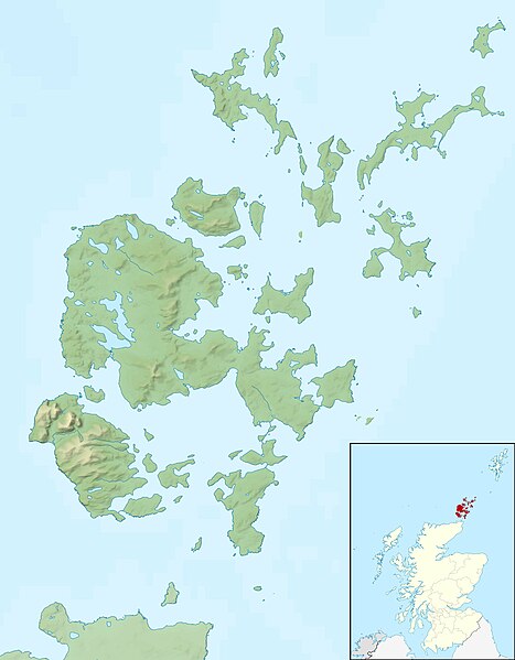
Relief map of the Orkney Islands (excluding Sule Stack and Sule Skerry), UK. Equirectangular map projection on WGS 84 datum, with N/S stretched 180% Geographic limits:
|
| Dátum | |
| Zdroj |
|
| Autor | Nilfanion, created using Ordnance Survey data |
| Povolenie (Využívanie tohto súboru) |
Tento súbor podlieha licencii Creative Commons Attribution-Share Alike 3.0 Unported Uvedenie autora: Contains Ordnance Survey data © Crown copyright and database right
|
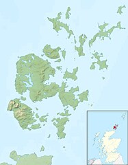
| Ďalšie verzie | File:Orkney Islands UK blank map.svg - Blank map |
História súboru
Po kliknutí na dátum/čas uvidíte ako súbor vyzeral vtedy.
| Dátum/Čas | Náhľad | Rozmery | Používateľ | Komentár | |
|---|---|---|---|---|---|
| aktuálna | 12:26, 30. november 2011 | | 2 004 × 2 572 (357 KB) | Nilfanion | {{Information |Description=Relief map of the Orkney Islands (excluding Sule Stack and Sule Skerry), UK. Equirectangular map projection on WGS 84 datum, with N/S stretched 180% Geographic limits: *W |
Použitie súboru
Na tento súbor odkazuje nasledujúca stránka:
Globálne využitie súborov
Nasledovné ďalšie wiki používajú tento súbor:
- Použitie na ar.wikipedia.org
- Použitie na bg.wikipedia.org
- Použitie na ceb.wikipedia.org
- Použitie na de.wikipedia.org
- Scapa Flow
- Bootsgrab von Scar
- Inganess Bay
- Westray Stone
- Taversoe Tuick
- Yetnasteen
- Sule Stack
- Blackhammer
- Broch von Windwick
- Knowes o’ Trotty
- Damsay
- Wideford Hill Cairn
- Vorlage:Positionskarte Schottland Orkney
- Benutzer:Metilsteiner/KARTENDIENSTE
- Loch of Stenness
- Loch of Harray
- Souterrain von Windwick
- Ness of Brodgar
- Benutzer Diskussion:Thgoiter/Archiv/2013
- Gräberfeld von Westness
- Benutzer Diskussion:Metilsteiner/Archiv/2013/April
- Muckle Skerry (Orkney)
- Kili Holm
- Kirkwall Castle
- Menhire von Stanerandy
- Holm of Grimbister
- Použitie na el.wikipedia.org
- Použitie na en.wikipedia.org
Zobraziť ďalšie globálne použitie tohto súboru.