
Súbor:Alexander Mackenzie map.jpg
Veľkosť tohto náhľadu: 773 × 600 pixelov. Iné rozlíšenia: 310 × 240 pixelov | 619 × 480 pixelov | 990 × 768 pixelov | 1 280 × 993 pixelov | 2 560 × 1 986 pixelov | 5 879 × 4 560 pixelov .
Pôvodný súbor (5 879 × 4 560 pixelov, veľkosť súboru: 9,24 MB, MIME typ: image/jpeg)
Zhrnutie
| Popis |
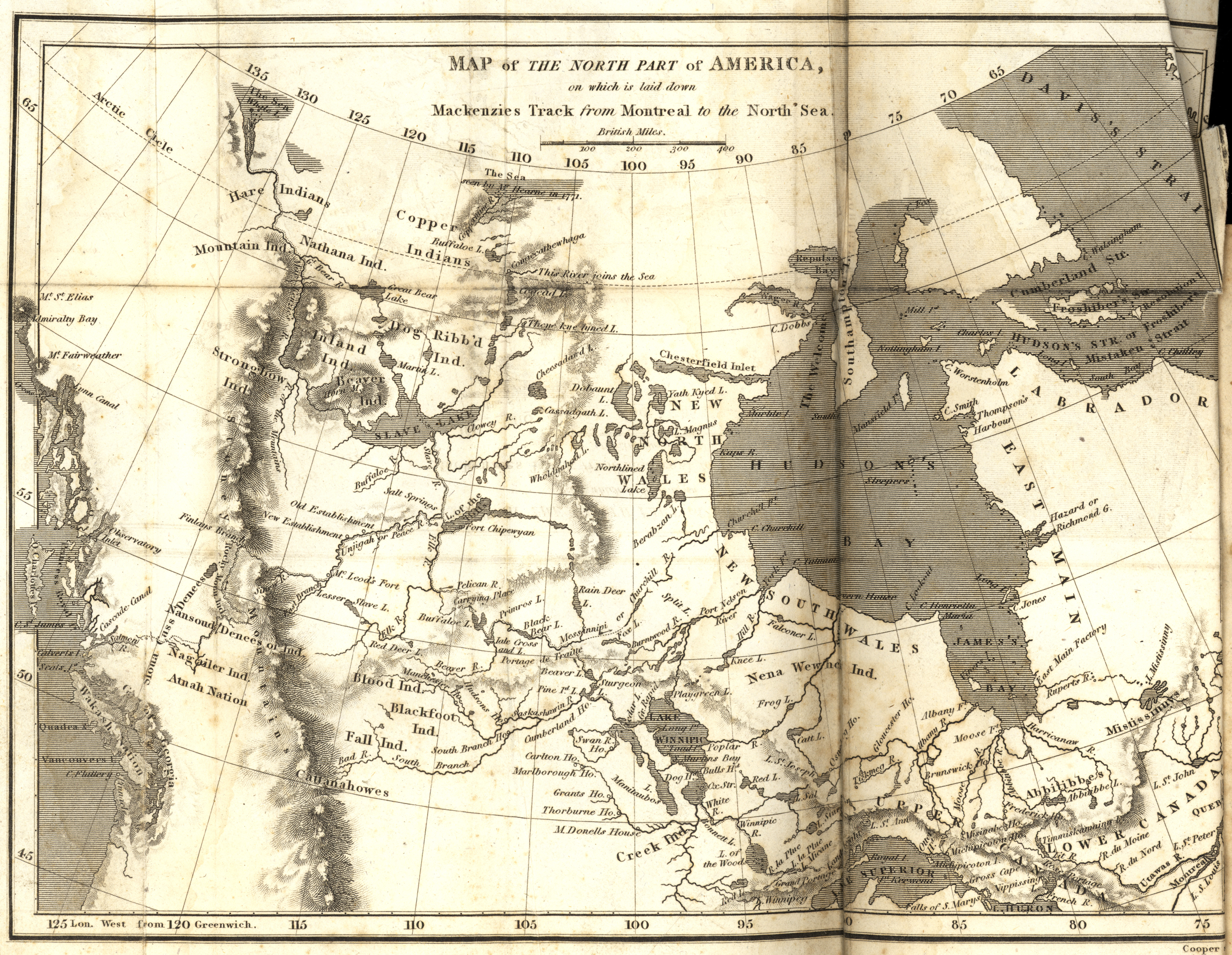
Mackenzie, Alexander. Map of the North Part of America on which is laid down Mackenzies Track (dotted line) from Montreal to the North Sea [map] Scale not given. In: A Collection of Voyages and Travels, from the Discovery of America to the Commencement of the Nineteenth Century (Volume 24). London: 1809. Image Courtesy of University of Manitoba Archives & Special Collections |
| Dátum | |
| Zdroj | Map of the North Part of America on which is laid down Mackenzies Track from Montreal to the North Sea (1809) |
| Autor | Manitoba Historical Maps |
Licencovanie
Tento súbor podlieha licencii Creative Commons Attribution 2.0 Generic
- Môžete slobodne:
- zdieľať – kopírovať, šíriť a prenášať dielo
- meniť ho – upravovať dielo
- Za nasledovných podmienok:
- uvedenie autorov – Musíte spomenúť autorov (jednotlivo alebo kolektívne), poskytnúť odkaz na licenciu a uviesť, či ste niečo zmenili. Môžete to urobiť ľubovoľným primeraným spôsobom, ale nie spôsobom naznačujúcim, že poskytovateľ licencie podporuje vás alebo vaše použitie diela.
| This image, originally posted to Flickr, was reviewed on September 14, 2010 by the administrator or reviewer File Upload Bot (Magnus Manske), who confirmed that it was available on Flickr under the stated license on that date. |
História súboru
Po kliknutí na dátum/čas uvidíte ako súbor vyzeral vtedy.
| Dátum/Čas | Náhľad | Rozmery | Používateľ | Komentár | |
|---|---|---|---|---|---|
| aktuálna | 06:19, 14. september 2010 | | 5 879 × 4 560 (9,24 MB) | File Upload Bot (Magnus Manske) | {{Information |Description=Mackenzie, Alexander. Map of the North Part of America on which is laid down Mackenzies Track from Montreal to the North Sea [map] Scale not given. In: A Collection of Voyages and Travels, from the Discovery of America to the Co |
Použitie súboru
Žiadne stránky neobsahujú odkazy na tento súbor.
Globálne využitie súborov
Nasledovné ďalšie wiki používajú tento súbor:
- Použitie na en.wikipedia.org
- Použitie na es.wikipedia.org
- Použitie na fr.wikipedia.org
- Použitie na nl.wikipedia.org