
Súbor:French Mandate for Syria and the Lebanon map en.svg

Veľkosť tohoto PNG náhľadu tohoto SVG súboru: 725 × 599 pixelov. Iné rozlíšenia: 290 × 240 pixelov | 581 × 480 pixelov | 929 × 768 pixelov | 1 239 × 1 024 pixelov | 2 478 × 2 048 pixelov | 922 × 762 pixelov .
Pôvodný súbor (SVG súbor, 922 × 762 pixelov, veľkosť súboru: 245 KB)
Zhrnutie
| Popis |
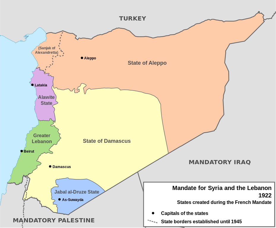
English: Map of French Mandate for Syria and the Lebanon and the states created in 1922, in English. Sources:
|
| Dátum | |
| Zdroj | Vlastné dielo, based on File:Syria, administrative divisions - de - colored.svg |
| Autor | Don-kun, TUBS, NordNordWest |
| Ďalšie verzie |
[]
|


Licencovanie
Ja, držiteľ autorských práv k tomuto dielu ho týmto zverejňujem za podmienok nasledovných licencií:

|
Bolo udelené povolenie kopírovať, širiť a/alebo meniť tento dokument za podmienok GNU Free Documentation License, verzie 1.2 alebo ktorejkoľvek neskoršej verzie publikovanej Free Software Foundation; bez Nemenných častí, bez Textov na prednej obálke a bez Textov na zadnej obálke. Kópia tejto licencie je zahrnutá v časti nazvanej GNU Free Documentation License. |
Tento súbor podlieha Creative Commons Attribution 3.0 Unported licencii
- Môžete slobodne:
- zdieľať – kopírovať, šíriť a prenášať dielo
- meniť ho – upravovať dielo
- Za nasledovných podmienok:
- uvedenie autorov – Musíte spomenúť autorov (jednotlivo alebo kolektívne), poskytnúť odkaz na licenciu a uviesť, či ste niečo zmenili. Môžete to urobiť ľubovoľným primeraným spôsobom, ale nie spôsobom naznačujúcim, že poskytovateľ licencie podporuje vás alebo vaše použitie diela.
Môžete si zvoliť ľubovolnú z týchto licencií.
História súboru
Po kliknutí na dátum/čas uvidíte ako súbor vyzeral vtedy.
| Dátum/Čas | Náhľad | Rozmery | Používateľ | Komentár | |
|---|---|---|---|---|---|
| aktuálna | 16:05, 4. február 2013 | | 922 × 762 (245 KB) | AnonMoos | Change "Libanon" to "Lebanon" |
| 15:33, 4. február 2013 |  | 922 × 762 (250 KB) | Don-kun | fix border to palestine, source: http://en.wikisource.org/wiki/Franco-British_Convention_on_Certain_Points_Connected_with_the_Mandates_for_Syria_and_the_Lebanon,_Palestine_and_Mesopotamia | |
| 18:43, 30. január 2013 |  | 922 × 762 (248 KB) | Don-kun | minus ahistorical lakes (and so all waterbodies) | |
| 21:44, 26. január 2013 |  | 922 × 762 (282 KB) | Don-kun | {{Information |Description ={{en|1=Map of French Mandate for Syria and the Lebanon and the states created in 1922, in English.}} |Source ={{own}}, based on File:Syria, administrative divisions - de - colored.svg |Author =[[User:... |
Použitie súboru
Globálne využitie súborov
Nasledovné ďalšie wiki používajú tento súbor:
- Použitie na af.wikipedia.org
- Použitie na ar.wikipedia.org
- Použitie na ast.wikipedia.org
- Použitie na azb.wikipedia.org
- Použitie na az.wikipedia.org
- Použitie na be.wikipedia.org
- Použitie na bg.wikipedia.org
- Použitie na bn.wikipedia.org
- Použitie na ca.wikipedia.org
- Použitie na cs.wikipedia.org
- Použitie na de.wikipedia.org
- Použitie na el.wikipedia.org
- Použitie na en.wikipedia.org
Zobraziť ďalšie globálne použitie tohto súboru.