
Súbor:Thessaly.jpg
Veľkosť tohto náhľadu: 665 × 600 pixelov. Iné rozlíšenia: 266 × 240 pixelov | 532 × 480 pixelov | 894 × 806 pixelov .
Pôvodný súbor (894 × 806 pixelov, veľkosť súboru: 1,18 MB, MIME typ: image/jpeg)
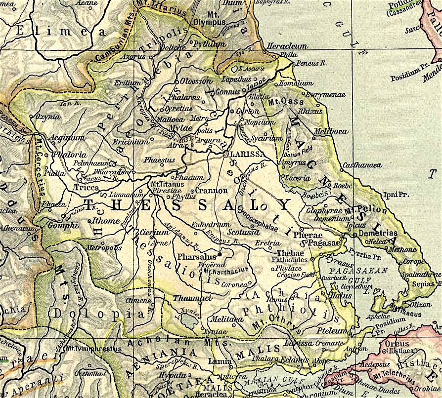
Map of Thessaly, cropped from old public domain map of Greece, from the Perry-Castañeda Library Map Collection, Historical Atlas by William R. Shepherd north, south
Tento súbor podlieha Creative Commons Attribution 3.0 Unported licencii
- Môžete slobodne:
- zdieľať – kopírovať, šíriť a prenášať dielo
- meniť ho – upravovať dielo
- Za nasledovných podmienok:
- uvedenie autorov – Musíte spomenúť autorov (jednotlivo alebo kolektívne), poskytnúť odkaz na licenciu a uviesť, či ste niečo zmenili. Môžete to urobiť ľubovoľným primeraným spôsobom, ale nie spôsobom naznačujúcim, že poskytovateľ licencie podporuje vás alebo vaše použitie diela.
História súboru
Po kliknutí na dátum/čas uvidíte ako súbor vyzeral vtedy.
| Dátum/Čas | Náhľad | Rozmery | Používateľ | Komentár | |
|---|---|---|---|---|---|
| aktuálna | 12:40, 1. november 2021 | | 894 × 806 (1,18 MB) | Claude Zygiel | Lighter |
| 15:44, 2. október 2010 |  | 894 × 806 (680 KB) | Cplakidas | widened to include Magnesia, which was considered part of wider Thessaly | |
| 08:22, 12. december 2006 |  | 769 × 778 (226 KB) | Roke~commonswiki | Map of Thessaly, cropped from old public domain map of Greece, from the Perry-Castañeda Library Map Collection, Historical Atlas by William R. Shepherd [http://www.lib.utexas.edu/maps/historical/shepherd/greece_ancient_n_ref_1926.jpg north], [http://www. |
Použitie súboru
Žiadne stránky neobsahujú odkazy na tento súbor.
Globálne využitie súborov
Nasledovné ďalšie wiki používajú tento súbor:
- Použitie na an.wikipedia.org
- Použitie na bg.wikipedia.org
- Použitie na ca.wikipedia.org
- Použitie na ceb.wikipedia.org
- Použitie na cs.wikipedia.org
- Použitie na de.wikipedia.org
- Použitie na el.wikipedia.org
- Použitie na en.wikipedia.org
- Thessaly
- Pagasae
- Demetrias
- Phylace (Thessaly)
- Pherae
- Tripolis Larisaia
- Tripolis (Perrhaebia)
- Pythion
- Doliche (Thessaly)
- History of Thessaly
- Palaepharsalus
- Argissa Magoula
- Eurymenae
- Amphrysus
- Gomphi
- Halos (Thessaly)
- Homolium
- Rhizus
- Tricca
- Phalanna
- Perrhaebia
- Pelasgiotis
- Ancient Thessaly
- Pimpleia
- Pelinna
- Pharcadon
- Argos Pelasgikon
- Boebe (Thessaly)
Zobraziť ďalšie globálne použitie tohto súboru.