
Súbor:Czech Republic districts.png
Veľkosť tohto náhľadu: 800 × 540 pixelov. Iné rozlíšenia: 320 × 216 pixelov | 640 × 432 pixelov | 1 024 × 692 pixelov | 1 300 × 878 pixelov .
Pôvodný súbor (1 300 × 878 pixelov, veľkosť súboru: 42 KB, MIME typ: image/png)
Zhrnutie
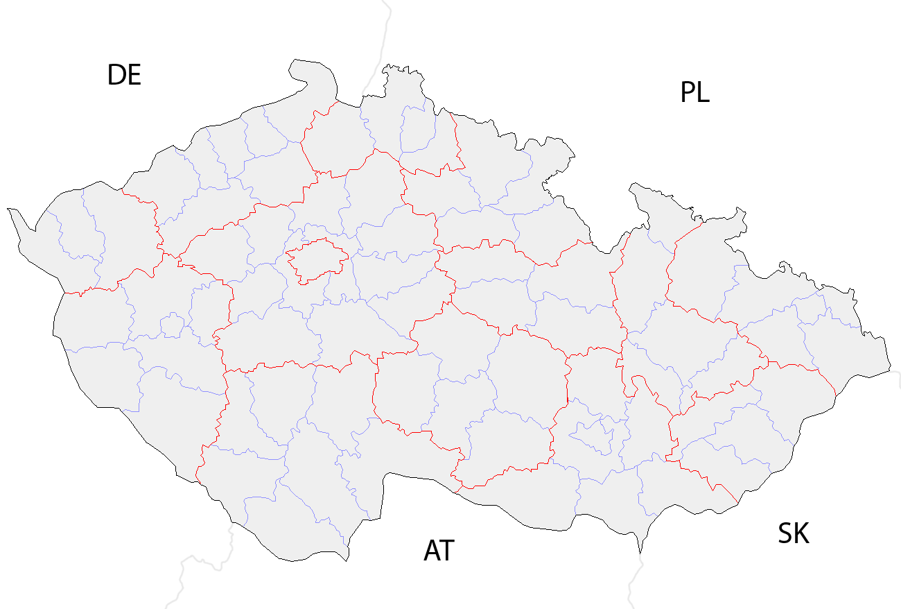
| Popis | Map of the districts of the Czech Republic showing former district borders before December 31, 2006. Created by Rarelibra 18:42, 29 December 2006 (UTC) for public domain use, using MapInfo Professional v8.5 and various mapping resources. |
| Dátum | 29. decembra 2006 (datum prvotního načtení souboru) |
| Zdroj | No machine-readable source provided. Own work assumed (based on copyright claims). |
| Autor | No machine-readable author provided. Rarelibra assumed (based on copyright claims). |
Licencovanie
| Ja, držiteľ autorských práv k tomuto dielu, uvoľňujem toto dielo ako voľné dielo (public domain). Toto platí celosvetovo. V niektorých krajinách to zákon neumožňuje; v tom prípade: Udeľujem komukoľvek právo používať toto dielo na ľubovoľné účely, bez akýchkoľvek podmienok ak také podmienky nevyžaduje zákon. |
História súboru
Po kliknutí na dátum/čas uvidíte ako súbor vyzeral vtedy.
| Dátum/Čas | Náhľad | Rozmery | Používateľ | Komentár | |
|---|---|---|---|---|---|
| aktuálna | 10:14, 2. október 2008 | | 1 300 × 878 (42 KB) | Happenstance | rv myself |
| 10:05, 2. október 2008 |  | 1 300 × 878 (42 KB) | Happenstance | lightening country codes | |
| 10:02, 2. október 2008 |  | 1 300 × 878 (42 KB) | Happenstance | added transparency, foreign borders and country codes, separated borders between okresy and borders between kraje | |
| 18:42, 29. december 2006 |  | 1 281 × 878 (30 KB) | Rarelibra | Map of the districts of the Czech Republic. Created by ~~~~ for public domain use, using MapInfo Professional v8.5 and various mapping resources. |
Použitie súboru
Žiadne stránky neobsahujú odkazy na tento súbor.
Globálne využitie súborov
Nasledovné ďalšie wiki používajú tento súbor:
- Použitie na br.wikipedia.org
- Použitie na da.wikipedia.org
- Použitie na en.wikipedia.org
- Použitie na eo.wikipedia.org
- Použitie na es.wikipedia.org
- Použitie na fa.wikipedia.org
- Použitie na gl.wikipedia.org
- Použitie na hu.wikipedia.org
- Použitie na it.wikipedia.org
- Použitie na ko.wikipedia.org
- Použitie na la.wikipedia.org
- Použitie na lmo.wikipedia.org
- Použitie na ms.wikipedia.org
- Použitie na nl.wikipedia.org
- Použitie na or.wikipedia.org
- Použitie na pa.wikipedia.org
- Použitie na pl.wikipedia.org
- Použitie na pnb.wikipedia.org
- Použitie na pt.wikipedia.org
- Použitie na ro.wikipedia.org
- Použitie na sh.wikipedia.org
- Použitie na sv.wikipedia.org
- Použitie na tr.wikipedia.org
- Použitie na uk.wikipedia.org
- Použitie na ur.wikipedia.org
- Použitie na vi.wikipedia.org
- Použitie na zh.wikipedia.org