
Súbor:Mexico map, MX-BCS.svg

Veľkosť tohoto PNG náhľadu tohoto SVG súboru: 800 × 544 pixelov. Iné rozlíšenia: 320 × 218 pixelov | 640 × 435 pixelov | 1 024 × 696 pixelov | 1 280 × 870 pixelov | 2 560 × 1 741 pixelov | 1 000 × 680 pixelov .
Pôvodný súbor (SVG súbor, 1 000 × 680 pixelov, veľkosť súboru: 123 KB)
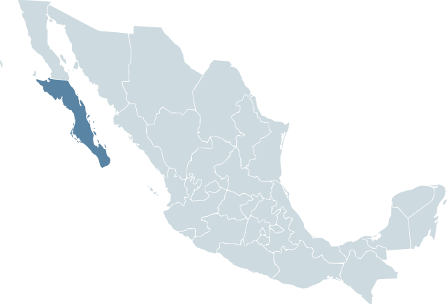
| Popis | Locator map for the state of Baja California Sur within Mexico. | ||||
| Dátum | 04-07-2007 | ||||
| Zdroj | Mexico template.svg by Mario Fuente Cid and Lokal_Profil | ||||
| Autor | Lokal_Profil | ||||
| Povolenie (Využívanie tohto súboru) |
Original image licensed under
|
História súboru
Po kliknutí na dátum/čas uvidíte ako súbor vyzeral vtedy.
| Dátum/Čas | Náhľad | Rozmery | Používateľ | Komentár | |
|---|---|---|---|---|---|
| aktuálna | 01:15, 19. november 2007 | | 1 000 × 680 (123 KB) | El bart089 | Based on the image made by Lokal Profil |
| 17:27, 4. júl 2007 |  | 1 000 × 680 (117 KB) | Lokal Profil | {{Information |Description=Locator map for the state of Category:Baja California Sur within Mexico. |Source=Image:Mexico template.svg by Mario Fuente Cid <small>and Lokal_Profil</small> |Date=04-07-2007 |
Použitie súboru
Žiadne stránky neobsahujú odkazy na tento súbor.
Globálne využitie súborov
Nasledovné ďalšie wiki používajú tento súbor:
- Použitie na ay.wikipedia.org
- Použitie na cy.wikipedia.org
- Použitie na en.wiktionary.org
- Použitie na es.wikipedia.org
- Použitie na incubator.wikimedia.org
- Použitie na ka.wikipedia.org
- Použitie na lv.wikipedia.org
- Použitie na mr.wikipedia.org
- Použitie na nn.wikipedia.org
- Použitie na pl.wikipedia.org
- Použitie na ro.wikipedia.org
- Použitie na ru.wikipedia.org
- Použitie na sco.wikipedia.org
- Použitie na simple.wikipedia.org
- Použitie na sv.wikipedia.org
- Použitie na sw.wikipedia.org
- Použitie na uk.wikipedia.org
- Použitie na war.wikipedia.org
- Použitie na zh.wikipedia.org