
Súbor:Quebec-map.png
Nie je dostupné vyššie rozlíšenie.
Quebec-map.png (280 × 230 pixelov, veľkosť súboru: 15 KB, MIME typ: image/png)

|
K tomuto obrázku existuje vektorová verzia (v SVG).
Ak je lepšia, používajte radšej tú. File:Quebec-map.png → File:Québec, Canada.svg
Podrobnejšie informácie o vektorovej grafike nájdete na stránke Commons:Transition to SVG. Taktiež si môžete prečítať informácie o podpore formátu SVG v MediaWiki. |
 |
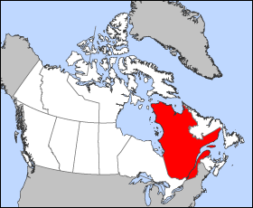
Map of Quebec (Canada)
Projection: Lambert azimuthal equal-area
Geospatial data from: The Atlas of Canada, The National Atlas of the United States and U.S. Geological Survey
Cartographer: John Fowler
| Ja, držiteľ autorských práv k tomuto dielu, uvoľňujem toto dielo ako voľné dielo (public domain). Toto platí celosvetovo. V niektorých krajinách to zákon neumožňuje; v tom prípade: Udeľujem komukoľvek právo používať toto dielo na ľubovoľné účely, bez akýchkoľvek podmienok ak také podmienky nevyžaduje zákon. |
História súboru
Po kliknutí na dátum/čas uvidíte ako súbor vyzeral vtedy.
| Dátum/Čas | Náhľad | Rozmery | Používateľ | Komentár | |
|---|---|---|---|---|---|
| aktuálna | 12:18, 24. marec 2005 | | 280 × 230 (15 KB) | Voyager | Map of Québec Projection: Lambert azimuthal equal-area Geospatial data from: [http://atlas.gc.ca/ The Atlas of Canada], [http://www.nationalatlas.gov/ The National Atlas of the United States] and [http://www.usgs.gov U.S. Geological Survey] Cartograph |
Použitie súboru
Žiadne stránky neobsahujú odkazy na tento súbor.
Globálne využitie súborov
Nasledovné ďalšie wiki používajú tento súbor:
- Použitie na en.wikinews.org
- Liberal minority government elected in Quebec
- Overcrowded Montreal hospital asks public to stay away
- Accused killer of Canadian police officer released on bail
- Gilles Duceppe drops out of Parti Québécois leadership race
- 14 people injured after bus overturns in heavy rain near Quebec City
- Quebec man found not guilty in shooting death of Laval officer
- Použitie na en.wiktionary.org
- Použitie na es.wikipedia.org
- Použitie na fr.wikinews.org
- Použitie na he.wikivoyage.org
- Použitie na pl.wikivoyage.org
- Použitie na su.wikipedia.org
- Použitie na sv.wikivoyage.org
- Použitie na test2.wikipedia.org
- Použitie na uk.wikivoyage.org
- Použitie na www.wikidata.org