
Súbor:Satellite image of The Azores in May 2003.jpg

Veľkosť tohto náhľadu: 800 × 580 pixelov. Iné rozlíšenia: 320 × 232 pixelov | 640 × 464 pixelov | 1 024 × 742 pixelov | 1 374 × 996 pixelov .
Pôvodný súbor (1 374 × 996 pixelov, veľkosť súboru: 46 KB, MIME typ: image/jpeg)
Zhrnutie
| Popis |
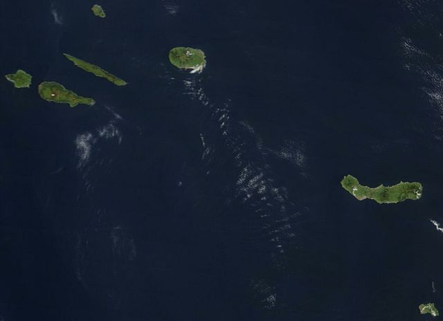
Deutsch: Satellitenbild der Azoren (ohne Flores und Corvo)
English: Satellite image of The Azores in May 2003 missing Flores and Corvo in the west. Hundreds of miles off the coast of Portugal, the nine islands of the Azores chains are stretched out over the Atlantic Ocean. This Moderate Resolution Imaging Spectroradiometer (MODIS) image from the Terra satellite on May 1, 2003, shows seven of the nine islands: (from left to right) Faial, Pico, São Jorge, Graciosa (north), Terceira, São Miguel, and Santa Maria. |
| Dátum | |
| Zdroj | http://visibleearth.nasa.gov/view_rec.php?id=5463 |
| Autor | Jeff Schmaltz, MODIS Rapid Response Team, NASA/GSFC |
| Ďalšie verzie | original, uncropped version: File:Azores satellite photo-NASA.jpg |
| Toto je upravený obrázek, což znamená, že byl oproti původní verzi digitálně změněn. Úpravy: cropped.
|
Licencovanie
| This file is in the public domain in the United States because it was solely created by NASA. NASA copyright policy states that "NASA material is not protected by copyright unless noted". (See Template:PD-USGov, NASA copyright policy page or JPL Image Use Policy.) | ||
 |
Warnings:
|
| Poznámky | K tomuto souboru existují poznámky: Prohlédnout si poznámky na Commons |
História súboru
Po kliknutí na dátum/čas uvidíte ako súbor vyzeral vtedy.
| Dátum/Čas | Náhľad | Rozmery | Používateľ | Komentár | |
|---|---|---|---|---|---|
| aktuálna | 15:57, 10. apríl 2005 | | 1 374 × 996 (46 KB) | Hautala | {{PD-USGov-NASA}} Satellite image of The Azores in May 2003 missing Flores and Corvo in the west. Slightly cropped image, taken from NASA's Visible Earth http://visibleearth.nasa.gov/view_rec.php?id=5463 . NASA's description: :Hundreds of miles off the c |
Použitie súboru
Na tento súbor odkazuje nasledujúca stránka:
Globálne využitie súborov
Nasledovné ďalšie wiki používajú tento súbor:
- Použitie na als.wikipedia.org
- Použitie na bg.wikipedia.org
- Použitie na cs.wikipedia.org
- Použitie na da.wikipedia.org
- Použitie na de.wikipedia.org
- Použitie na fi.wikipedia.org
- Použitie na frr.wikipedia.org
- Použitie na he.wikipedia.org
- Použitie na it.wikipedia.org
- Použitie na lt.wikipedia.org