
Súbor:SpainDueroBasin.png

Veľkosť tohto náhľadu: 800 × 572 pixelov. Iné rozlíšenia: 320 × 229 pixelov | 640 × 457 pixelov | 1 024 × 732 pixelov | 1 280 × 915 pixelov | 1 748 × 1 249 pixelov .
Pôvodný súbor (1 748 × 1 249 pixelov, veľkosť súboru: 2,55 MB, MIME typ: image/png)
Zhrnutie
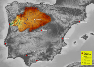
| Popis | Map of Duero river basin in Spain, Karte des hydrogeografischen Beckens des Duero |
| Dátum | |
| Zdroj | Own work, based on an image of http://www.maps-for-free.com/ (Creative Commons Attribution Share Alike 3.0) |
| Autor | Port(u*o)s |
| Povolenie (Využívanie tohto súboru) |
Creative Commons Attribution Share Alike 3.0 |
Licencovanie
Tento súbor podlieha licencii Creative Commons Attribution-Share Alike 3.0 Unported
- Môžete slobodne:
- zdieľať – kopírovať, šíriť a prenášať dielo
- meniť ho – upravovať dielo
- Za nasledovných podmienok:
- uvedenie autorov – Musíte spomenúť autorov (jednotlivo alebo kolektívne), poskytnúť odkaz na licenciu a uviesť, či ste niečo zmenili. Môžete to urobiť ľubovoľným primeraným spôsobom, ale nie spôsobom naznačujúcim, že poskytovateľ licencie podporuje vás alebo vaše použitie diela.
- meniť za rovnakých podmienok – Ak toto dielo zmeníte, prevediete do inej formy alebo použijete ako základ iného diela, musíte výsledok šíriť pod rovnakou alebo kompatibilnou licenciou ako originál.
História súboru
Po kliknutí na dátum/čas uvidíte ako súbor vyzeral vtedy.
| Dátum/Čas | Náhľad | Rozmery | Používateľ | Komentár | |
|---|---|---|---|---|---|
| aktuálna | 16:41, 7. október 2021 | | 1 748 × 1 249 (2,55 MB) | Lojwe | Santiago mal posicionada |
| 01:51, 5. február 2019 |  | 1 748 × 1 249 (2,11 MB) | TouchName | recorte de marco | |
| 02:07, 30. október 2007 |  | 1 808 × 1 307 (2,57 MB) | Port(u*o)s | == Summary == {{Information |Description=Map of Duero river basin in Spain, Karte des hydrogeografischen Beckens des Duero |Source= Own work, based on an image of http://www.maps-for-free.com/ (Creative Commons Attribution Share Alike 3.0) |Date=October 2 |
Použitie súboru
Na tento súbor odkazuje nasledujúca stránka:
Globálne využitie súborov
Nasledovné ďalšie wiki používajú tento súbor:
- Použitie na af.wikipedia.org
- Použitie na ast.wikipedia.org
- Použitie na ca.wikipedia.org
- Použitie na cs.wikipedia.org
- Použitie na cv.wikipedia.org
- Použitie na de.wikipedia.org
- Použitie na el.wikipedia.org
- Použitie na eo.wikipedia.org
- Použitie na es.wikipedia.org
- Duero
- Río Carrión
- Pisuerga
- Eresma
- Adaja
- Río Arlanza
- Río Aliste
- Río Tera
- Río Zapardiel
- Río Guareña
- Río Huebra
- Río Jerga
- Úrbel
- Voltoya
- Río Duratón
- Río Margañán
- Anexo:Ríos de España
- Usuario discusión:NACLE
- Río Malo
- Cuenca hidrográfica del Duero
- Río Valdeginate
- Río Almar
- Río Grande (afluente del Carrión)
- Río Arevalillo
- Plantilla:Ficha de cuerpo de agua
- Plantilla:Ficha de cuerpo de agua/doc
- Río Negro (afluente del Omaña)
- Río Navajos
- Río Valdesamario
- Río Castro (afluente del Tera)
- Río Manzanas
- Río Tuela
- Río Gamoneda
- Río Truchas
- Río Cueza
Zobraziť ďalšie globálne použitie tohto súboru.