
Súbor:TCDD System Map.GIF
Veľkosť tohto náhľadu: 800 × 368 pixelov. Iné rozlíšenia: 320 × 147 pixelov | 640 × 294 pixelov | 1 024 × 471 pixelov | 1 280 × 588 pixelov | 2 828 × 1 300 pixelov .
Pôvodný súbor (2 828 × 1 300 pixelov, veľkosť súboru: 397 KB, MIME typ: image/gif)
Zhrnutie
| Popis |
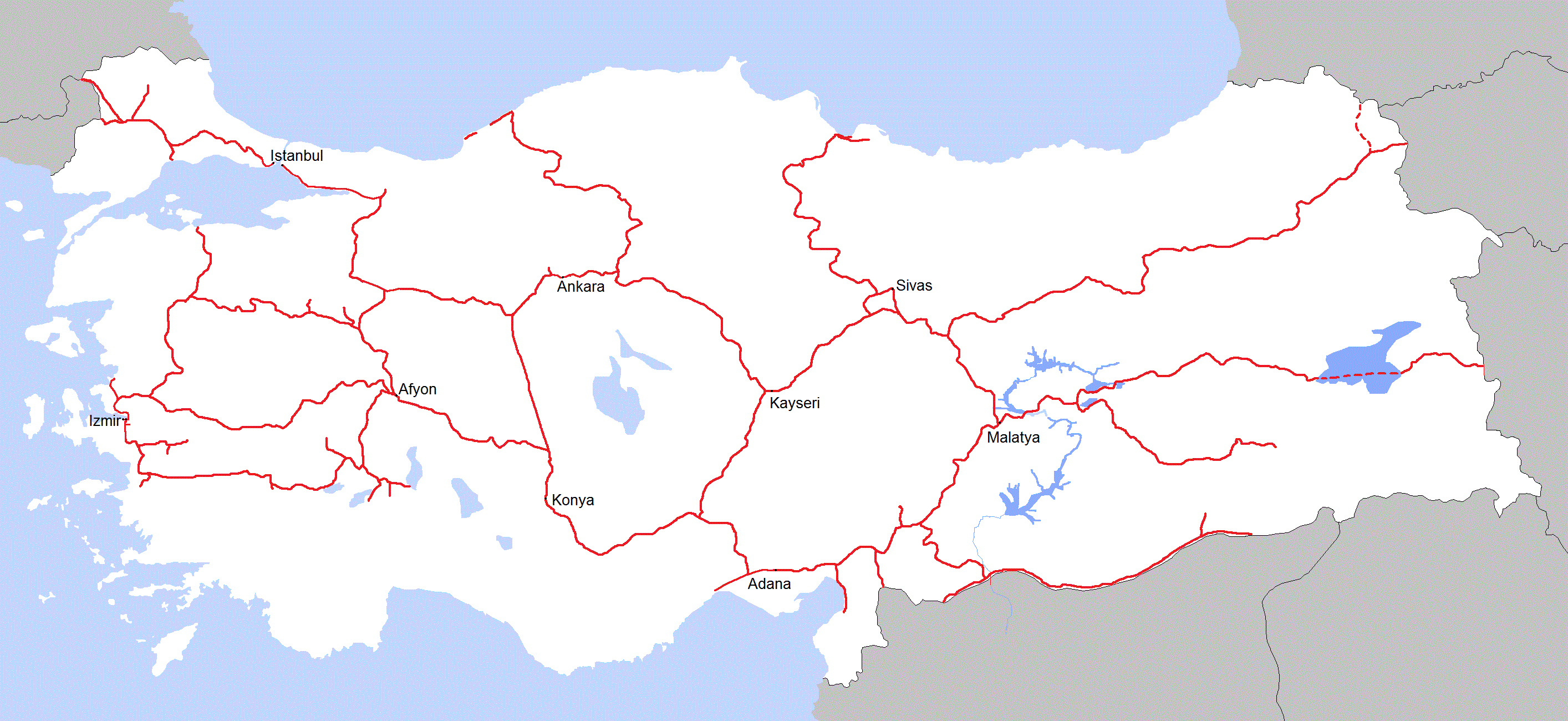
English: System map of Turkish State Railways |
| Dátum | |
| Zdroj | Vlastné dielo (Original text: I created this work entirely by myself.) |
| Autor | Central Data Bank |
Licencovanie
Central Data Bank v projekte Wikipédia (angličtina), držiteľ autorských práv k tomuto dielu ho týmto zverejňuje za podmienok nasledovnej licencie:
Tento súbor podlieha Creative Commons Attribution 3.0 Unported licencii
Uvedenie autora: Central Data Bank v projekte Wikipédia (angličtina)
- Môžete slobodne:
- zdieľať – kopírovať, šíriť a prenášať dielo
- meniť ho – upravovať dielo
- Za nasledovných podmienok:
- uvedenie autorov – Musíte spomenúť autorov (jednotlivo alebo kolektívne), poskytnúť odkaz na licenciu a uviesť, či ste niečo zmenili. Môžete to urobiť ľubovoľným primeraným spôsobom, ale nie spôsobom naznačujúcim, že poskytovateľ licencie podporuje vás alebo vaše použitie diela.
Pôvodný záznam nahrávaní
Transferred from en.wikipedia to Commons by Classical geographer.
The original description page was here. All following user names refer to en.wikipedia.
- 2010-07-09 18:33 Central Data Bank 2828×1300× (48650 bytes) {{Information |Description = |Source = I created this work entirely by myself. |Date = July 7, 2010 |Author = Central Data Bank |other_versions = }}
História súboru
Po kliknutí na dátum/čas uvidíte ako súbor vyzeral vtedy.
| Dátum/Čas | Náhľad | Rozmery | Používateľ | Komentár | |
|---|---|---|---|---|---|
| aktuálna | 21:40, 19. november 2011 | | 2 828 × 1 300 (397 KB) | Central Data Bank~commonswiki | Changed colors and edited borders. |
| 15:59, 10. september 2011 |  | 2 828 × 1 300 (149 KB) | Central Data Bank~commonswiki | Chnaged the districts and added new routes. | |
| 08:31, 23. júl 2010 |  | 2 828 × 1 300 (48 KB) | Classical geographer | {{Information |Description={{en|''no original description''}} |Source=Transferred from [http://en.wikipedia.org en.wikipedia]; transfer was stated to be made by User:Classical geographer.<br/> (Original text : ''I created this work entirely by myself. |
Použitie súboru
Žiadne stránky neobsahujú odkazy na tento súbor.
Globálne využitie súborov
Nasledovné ďalšie wiki používajú tento súbor:
- Použitie na de.wikipedia.org
- Použitie na en.wikipedia.org