
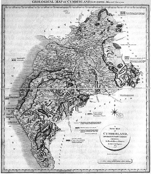
Súbor:William Smith geological map of Cumberland.jpg

Pôvodný súbor (1 070 × 1 232 pixelov, veľkosť súboru: 506 KB, MIME typ: image/jpeg)
Zhrnutie
| Popis | William Smith's geological map of Cumberland, 1824 |
| Dátum | |
| Zdroj | Scan by User:Geoz, 2005. Some image editing by Jo |
| Autor | drwan by en:William Smith, scan by User:Geoz, 2005. Some image editing by Jo, 2008 |
Licencovanie
|
Toto dílo je volné také v zemích, jejichž právní řád chrání majetková autorská práva po dobu života autora a 70 let po jeho smrti.
| |
| Tento súbor bol identifikovaný, že nemá žiadne známe obmedzenia vyplývajúce z autorského zákona vrátane všetkých súvisiacich a susedných práv. | |
História súboru
Po kliknutí na dátum/čas uvidíte ako súbor vyzeral vtedy.
| Dátum/Čas | Náhľad | Rozmery | Používateľ | Komentár | |
|---|---|---|---|---|---|
| aktuálna | 20:30, 18. január 2008 | | 1 070 × 1 232 (506 KB) | Jo Weber | == Summary == William Smith's geological map of Cumberland, 1824. Scan by User:Geoz, 2005. == Licensing == {{PD-old}} Category:Geological maps |
| 12:12, 4. november 2005 |  | 1 089 × 1 233 (521 KB) | Geoz | William Smith's geological map of Cumberland, 1824. Scan by User:Geoz, 2005. |
Použitie súboru
Na tento súbor odkazuje nasledujúcich 5 stránok: