
Súbor:Karte AT Burgenland.svg

Veľkosť tohoto PNG náhľadu tohoto SVG súboru: 800 × 440 pixelov. Iné rozlíšenia: 320 × 176 pixelov | 640 × 352 pixelov | 1 024 × 563 pixelov | 1 280 × 704 pixelov | 2 560 × 1 408 pixelov | 1 000 × 550 pixelov .
Pôvodný súbor (SVG súbor, 1 000 × 550 pixelov, veľkosť súboru: 66 KB)
Zhrnutie
| Popis |
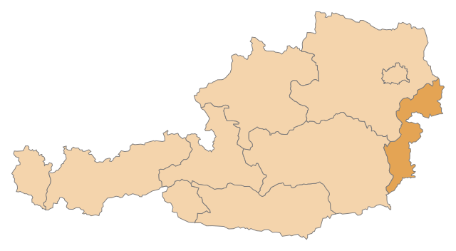
English: Map of the States of Austria, highlighting Burgenland
Deutsch: Karte der Bundesländer Österreichs, Burgenland hervorgehoben |
| Dátum | |
| Zdroj | Vlastné dielo |
| Autor | AleXXw |
Licencovanie
| Ja, držiteľ autorských práv k tomuto dielu, uvoľňujem toto dielo ako voľné dielo (public domain). Toto platí celosvetovo. V niektorých krajinách to zákon neumožňuje; v tom prípade: Udeľujem komukoľvek právo používať toto dielo na ľubovoľné účely, bez akýchkoľvek podmienok ak také podmienky nevyžaduje zákon. |
História súboru
Po kliknutí na dátum/čas uvidíte ako súbor vyzeral vtedy.
| Dátum/Čas | Náhľad | Rozmery | Používateľ | Komentár | |
|---|---|---|---|---|---|
| aktuálna | 21:52, 12. máj 2009 | | 1 000 × 550 (66 KB) | AleXXw | == Beschreibung == {{Information |Description={{en|1=Map of the States of Austria, highlighting Burgenland}} {{de|1=Karte der Bundesländer Österreichs, Burgenland hervorgehoben}} |Source=Eigenes Werk (own work) |Author=AleXXw |Date=2009- |
Použitie súboru
Na tento súbor odkazuje nasledujúcich 11 stránok:
Globálne využitie súborov
Nasledovné ďalšie wiki používajú tento súbor:
- Použitie na an.wikipedia.org
- Použitie na bs.wikipedia.org
- Gradišće
- Raiding
- Šablon:Pokrajina Gradišće
- Oberpullendorf (okrug)
- Eisenstadt
- Eisenstadt-Umgebung
- Neufeld an der Leitha
- Neusiedl am See (okrug)
- Güssing (okrug)
- Jennersdorf (okrug)
- Mattersburg (okrug)
- Oberwart (okrug)
- Kategorija:Okruzi Austrije
- Spisak okruga i statutarnih gradova u Austriji
- Neusiedl am See (grad)
- Oslip
- Použitie na ca.wikipedia.org
- Použitie na de.wikipedia.org
- Použitie na de.wikinews.org
- Použitie na fa.wikipedia.org
- Použitie na hr.wikipedia.org
- Použitie na id.wikipedia.org
- Použitie na ko.wikipedia.org
- Použitie na lb.wikipedia.org
- Použitie na lt.wikipedia.org
- Použitie na mr.wikipedia.org
- Použitie na pnb.wikipedia.org
- Použitie na ps.wikipedia.org
- Použitie na pt.wikipedia.org
- Použitie na sv.wikipedia.org
Zobraziť ďalšie globálne použitie tohto súboru.