
Súbor:Monte Carlo Formula 1 track map with streets.svg

Veľkosť tohoto PNG náhľadu tohoto SVG súboru: 800 × 546 pixelov. Iné rozlíšenia: 320 × 218 pixelov | 640 × 437 pixelov | 1 024 × 699 pixelov | 1 280 × 874 pixelov | 2 560 × 1 748 pixelov | 1 781 × 1 216 pixelov .
Pôvodný súbor (SVG súbor, 1 781 × 1 216 pixelov, veľkosť súboru: 330 KB)
Zhrnutie
| Popis |
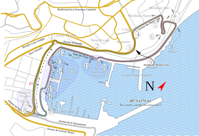
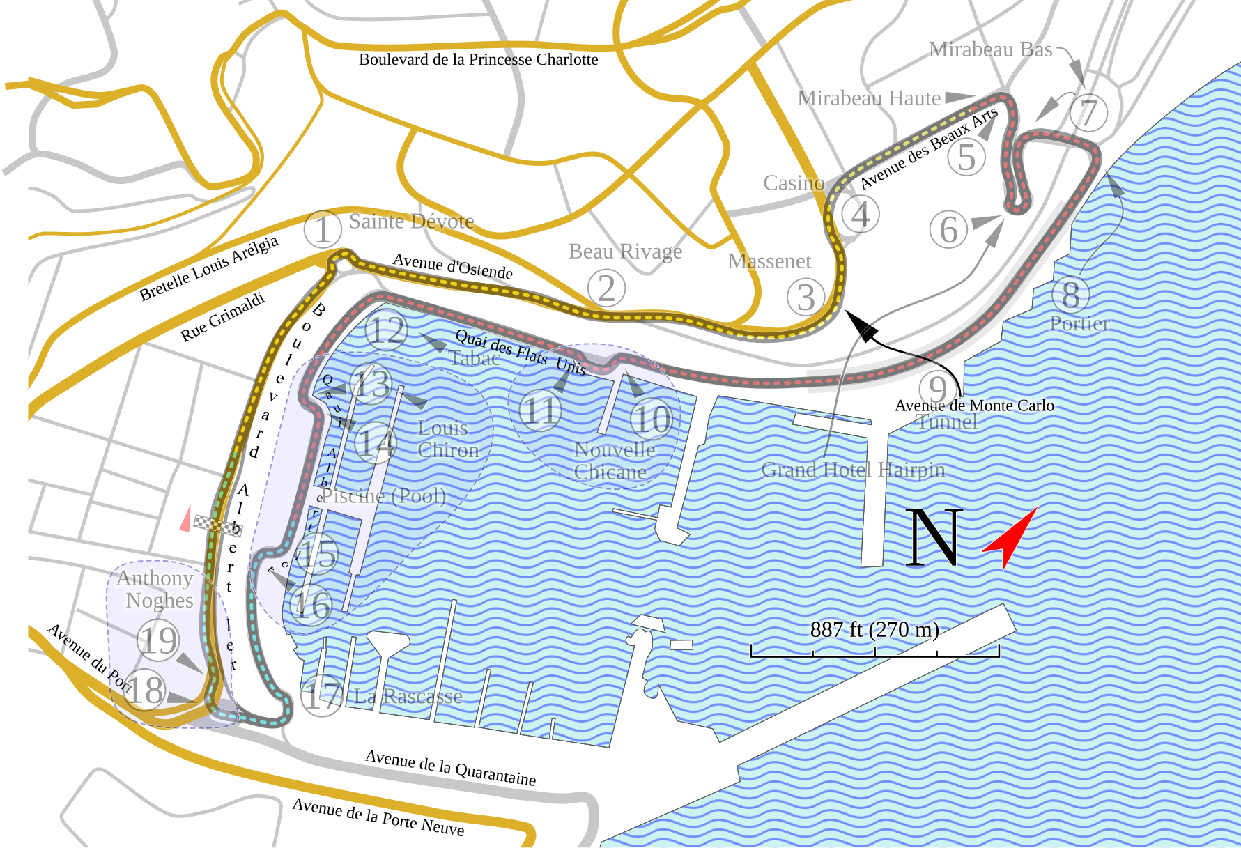
English: This version of my Monte Carlo track map has more information, but is less accurate in the placement of elements. |
| Dátum | |
| Zdroj | Vlastné dielo |
| Autor | Will Pittenger |
| Ďalšie verzie |
|


Táto W3C-nešpecifikovaná vektorová grafika bola vytvorená pomocou Inkscape .
| Pozícia kamery | | Tento a ďalšie obrázky na: OpenStreetMap |
|---|
Licencovanie
Ja, držiteľ autorských práv k tomuto dielu ho týmto zverejňujem za podmienok nasledovnej licencie:
Tento súbor podlieha licencii Creative Commons Attribution-Share Alike 3.0 Unported
- Môžete slobodne:
- zdieľať – kopírovať, šíriť a prenášať dielo
- meniť ho – upravovať dielo
- Za nasledovných podmienok:
- uvedenie autorov – Musíte spomenúť autorov (jednotlivo alebo kolektívne), poskytnúť odkaz na licenciu a uviesť, či ste niečo zmenili. Môžete to urobiť ľubovoľným primeraným spôsobom, ale nie spôsobom naznačujúcim, že poskytovateľ licencie podporuje vás alebo vaše použitie diela.
- meniť za rovnakých podmienok – Ak toto dielo zmeníte, prevediete do inej formy alebo použijete ako základ iného diela, musíte výsledok šíriť pod rovnakou alebo kompatibilnou licenciou ako originál.
História súboru
Po kliknutí na dátum/čas uvidíte ako súbor vyzeral vtedy.
| Dátum/Čas | Náhľad | Rozmery | Používateľ | Komentár | |
|---|---|---|---|---|---|
| aktuálna | 02:25, 25. september 2009 | | 1 781 × 1 216 (330 KB) | Will Pittenger | {{Information |Description={{en|1=This version of my Monte Carlo track map has more information, but is less accurate in the placement of elements.}} |Source=Own work by uploader |Author=Will Pittenger |Date=2009-09-24 |Permission= |
Použitie súboru
Na tento súbor odkazuje nasledujúca stránka:
Globálne využitie súborov
Nasledovné ďalšie wiki používajú tento súbor:
- Použitie na en.wikipedia.org
- Použitie na es.wikipedia.org
- Použitie na fr.wikipedia.org
- Použitie na gl.wikipedia.org
- Použitie na hu.wikipedia.org
- Použitie na hyw.wikipedia.org
- Použitie na ja.wikipedia.org
- Použitie na nl.wikipedia.org
- Použitie na no.wikipedia.org
- Použitie na zh.wikipedia.org