
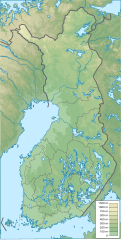
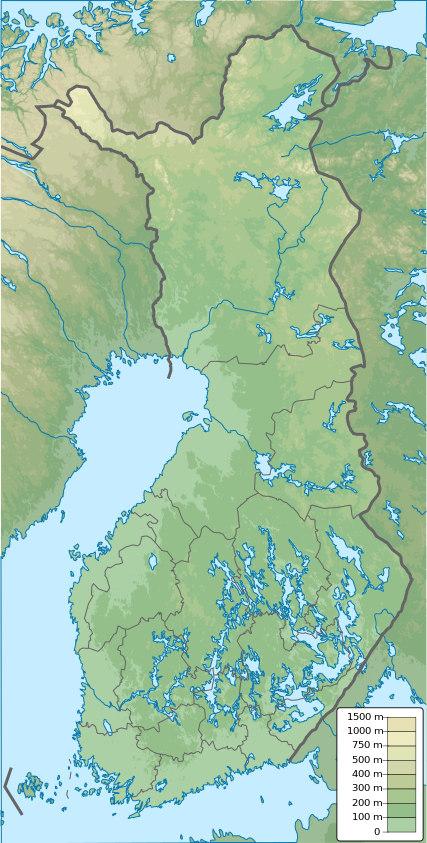
Súbor:Finland physical map.svg

Veľkosť tohoto PNG náhľadu tohoto SVG súboru: 303 × 598 pixelov. Iné rozlíšenia: 121 × 240 pixelov | 243 × 480 pixelov | 389 × 768 pixelov | 518 × 1 024 pixelov | 1 037 × 2 048 pixelov | 427 × 843 pixelov .
Pôvodný súbor (SVG súbor, 427 × 843 pixelov, veľkosť súboru: 3,97 MB)
Zhrnutie
| Popis |
English: Finland physical map, parameters equal to File:Finland location map.svg |
| Dátum | |
| Zdroj | Vlastné dielo |
| Autor | Urutseg |
Licencovanie
| Ja, držiteľ autorských práv k tomuto dielu, uvoľňujem toto dielo ako voľné dielo (public domain). Toto platí celosvetovo. V niektorých krajinách to zákon neumožňuje; v tom prípade: Udeľujem komukoľvek právo používať toto dielo na ľubovoľné účely, bez akýchkoľvek podmienok ak také podmienky nevyžaduje zákon. |
História súboru
Po kliknutí na dátum/čas uvidíte ako súbor vyzeral vtedy.
| Dátum/Čas | Náhľad | Rozmery | Používateľ | Komentár | |
|---|---|---|---|---|---|
| aktuálna | 12:09, 26. január 2021 | | 427 × 843 (3,97 MB) | Fenn-O-maniC | Updated regional borders as per https://asiointi.maanmittauslaitos.fi/karttapaikka/ |
| 23:39, 25. november 2019 |  | 427 × 843 (3,99 MB) | Pavouk | update border North_Ostrobothnia (+Vaala), delete Eastern Uusimaa, change border (Aland inside Finland, not out) | |
| 13:54, 13. február 2011 |  | 427 × 843 (3,99 MB) | Urutseg | {{Information |Description ={{en|1=Finland physical map, parameters equal to File:Finland location map.svg}} |Source ={{own}} |Author =Urutseg |Date =2011-02-13 |Permission = |other_versions = }} [[C |
Použitie súboru
Na tento súbor odkazuje nasledujúcich 7 stránok:
Globálne využitie súborov
Nasledovné ďalšie wiki používajú tento súbor:
- Použitie na am.wikipedia.org
- Použitie na av.wikipedia.org
- Použitie na az.wikipedia.org
- Použitie na be.wikipedia.org
- Použitie na bn.wikipedia.org
- Použitie na bs.wikipedia.org
- Použitie na ca.wikipedia.org
- Použitie na ceb.wikipedia.org
- Použitie na ce.wikipedia.org
- Použitie na ckb.wikipedia.org
- Použitie na da.wikipedia.org
Zobraziť ďalšie globálne použitie tohto súboru.