
Súbor:Karte A1 AT.svg

Veľkosť tohoto PNG náhľadu tohoto SVG súboru: 800 × 492 pixelov. Iné rozlíšenia: 320 × 197 pixelov | 640 × 394 pixelov | 1 024 × 630 pixelov | 1 280 × 788 pixelov | 2 560 × 1 575 pixelov | 1 950 × 1 200 pixelov .
Pôvodný súbor (SVG súbor, 1 950 × 1 200 pixelov, veľkosť súboru: 115 KB)
Zhrnutie
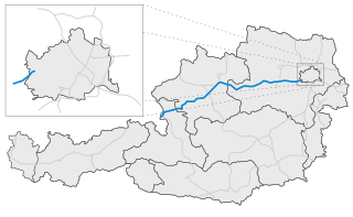
| Popis | Karte der österreichischen A1 / Map of austrian freeway A1 |
| Dátum | |
| Zdroj | Vlastné dielo |
| Autor | Alexander Wagner |
Licencovanie
Ja, držiteľ autorských práv k tomuto dielu ho týmto zverejňujem za podmienok nasledovnej licencie:
Tento súbor podlieha licencii Creative Commons Attribution-Share Alike 3.0 Unported
- Môžete slobodne:
- zdieľať – kopírovať, šíriť a prenášať dielo
- meniť ho – upravovať dielo
- Za nasledovných podmienok:
- uvedenie autorov – Musíte spomenúť autorov (jednotlivo alebo kolektívne), poskytnúť odkaz na licenciu a uviesť, či ste niečo zmenili. Môžete to urobiť ľubovoľným primeraným spôsobom, ale nie spôsobom naznačujúcim, že poskytovateľ licencie podporuje vás alebo vaše použitie diela.
- meniť za rovnakých podmienok – Ak toto dielo zmeníte, prevediete do inej formy alebo použijete ako základ iného diela, musíte výsledok šíriť pod rovnakou alebo kompatibilnou licenciou ako originál.
História súboru
Po kliknutí na dátum/čas uvidíte ako súbor vyzeral vtedy.
| Dátum/Čas | Náhľad | Rozmery | Používateľ | Komentár | |
|---|---|---|---|---|---|
| aktuálna | 17:31, 16. september 2009 | | 1 950 × 1 200 (115 KB) | AleXXw | Verbesserte Version |
| 20:59, 9. september 2009 |  | 1 950 × 1 200 (127 KB) | AleXXw | Detailansicht verbessert | |
| 17:02, 8. september 2009 |  | 2 100 × 1 200 (135 KB) | AleXXw | {{Information |Description=Karte der österreichischen A1 |Source=Eigenes Werk (own work) |Date=2009-09-08 |Author=Alexander Wagner |Permission= |other_versions= }} Category:Highway maps of Austria |
Použitie súboru
Na tento súbor odkazujú nasledujúce 2 stránky:
Globálne využitie súborov
Nasledovné ďalšie wiki používajú tento súbor:
- Použitie na cs.wikipedia.org
- Použitie na de.wikipedia.org
- Použitie na de.wikivoyage.org
- Použitie na en.wikipedia.org
- Použitie na hu.wikipedia.org
- Použitie na lmo.wikipedia.org
- Použitie na lv.wikipedia.org
- Použitie na ro.wikipedia.org
- Použitie na sh.wikipedia.org
- Použitie na sl.wikipedia.org
- Použitie na tr.wikipedia.org
- Použitie na uk.wikipedia.org
- Použitie na www.wikidata.org
- Použitie na zh.wikipedia.org