
Súbor:Map Charleroi.svg

Veľkosť tohoto PNG náhľadu tohoto SVG súboru: 609 × 600 pixelov. Iné rozlíšenia: 244 × 240 pixelov | 488 × 480 pixelov | 780 × 768 pixelov | 1 040 × 1 024 pixelov | 2 080 × 2 048 pixelov | 713 × 702 pixelov .
Pôvodný súbor (SVG súbor, 713 × 702 pixelov, veľkosť súboru: 95 KB)
Zhrnutie
| Popis |
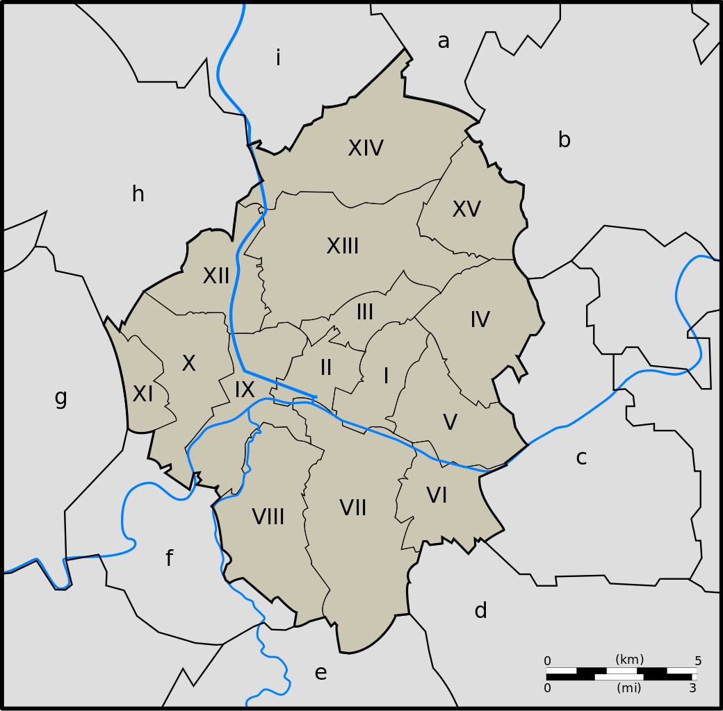
Map of Charleroi, Hainaut, Belgium. Français : Charleroi :
Neighbouring :
|
| Dátum | |
| Zdroj | Vlastné dielo |
| Autor | Jmh2o |
Licencovanie
Ja, držiteľ autorských práv k tomuto dielu ho týmto zverejňujem za podmienok nasledovných licencií:

|
Bolo udelené povolenie kopírovať, širiť a/alebo meniť tento dokument za podmienok GNU Free Documentation License, verzie 1.2 alebo ktorejkoľvek neskoršej verzie publikovanej Free Software Foundation; bez Nemenných častí, bez Textov na prednej obálke a bez Textov na zadnej obálke. Kópia tejto licencie je zahrnutá v časti nazvanej GNU Free Documentation License. |
Tento súbor je licencovaný za podmienok Creative Commons Attribution-Share Alike 3.0 Unported, 2.5 Generic, 2.0 Generic a 1.0 Generic.
- Môžete slobodne:
- zdieľať – kopírovať, šíriť a prenášať dielo
- meniť ho – upravovať dielo
- Za nasledovných podmienok:
- uvedenie autorov – Musíte spomenúť autorov (jednotlivo alebo kolektívne), poskytnúť odkaz na licenciu a uviesť, či ste niečo zmenili. Môžete to urobiť ľubovoľným primeraným spôsobom, ale nie spôsobom naznačujúcim, že poskytovateľ licencie podporuje vás alebo vaše použitie diela.
- meniť za rovnakých podmienok – Ak toto dielo zmeníte, prevediete do inej formy alebo použijete ako základ iného diela, musíte výsledok šíriť pod rovnakou alebo kompatibilnou licenciou ako originál.
Môžete si zvoliť ľubovolnú z týchto licencií.
História súboru
Po kliknutí na dátum/čas uvidíte ako súbor vyzeral vtedy.
| Dátum/Čas | Náhľad | Rozmery | Používateľ | Komentár | |
|---|---|---|---|---|---|
| aktuálna | 08:24, 12. február 2010 | | 713 × 702 (95 KB) | Jmh2o | Internationalisation : ajout des miles |
| 10:59, 11. február 2010 |  | 713 × 702 (85 KB) | Jmh2o | Scale - échelle | |
| 14:03, 22. december 2009 |  | 713 × 702 (80 KB) | Jmh2o | {{Information |Description={{fr|1=Carte de Charleroi}} |Source={{own}} |Author=Jmh2o |Date=2009-12-22 |Permission= |other_versions= }} Category:Maps of Charleroi |
Použitie súboru
Na tento súbor odkazujú nasledujúce 2 stránky:
Globálne využitie súborov
Nasledovné ďalšie wiki používajú tento súbor:
- Použitie na ast.wikipedia.org
- Použitie na de.wikipedia.org
- Použitie na en.wikipedia.org
- Použitie na en.wikivoyage.org
- Použitie na es.wikipedia.org
- Použitie na et.wikipedia.org
- Použitie na eu.wikipedia.org
- Použitie na fr.wikipedia.org
- Použitie na fy.wikipedia.org
- Použitie na id.wikipedia.org
- Použitie na it.wikipedia.org
- Použitie na lb.wikipedia.org
- Použitie na nl.wikipedia.org
- Použitie na pl.wikipedia.org
- Použitie na ro.wikipedia.org
- Použitie na vls.wikipedia.org
- Použitie na wa.wikipedia.org