
Súbor:Norway Regions Vestlandet Position.svg

Veľkosť tohoto PNG náhľadu tohoto SVG súboru: 562 × 600 pixelov. Iné rozlíšenia: 225 × 240 pixelov | 450 × 480 pixelov | 719 × 768 pixelov | 959 × 1 024 pixelov | 1 918 × 2 048 pixelov | 740 × 790 pixelov .
Pôvodný súbor (SVG súbor, 740 × 790 pixelov, veľkosť súboru: 51 KB)
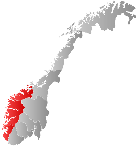
| Popis | Autogenerated locator map of Norwegian region as named in filename. |
| Dátum | |
| Zdroj | Based on Image:Norway counties blank.svg |
| Autor | Marmelad |
| Povolenie (Využívanie tohto súboru) |
Own work, share alike, attribution required (Creative Commons CC-BY-SA-2.5) |
Ja, držiteľ autorských práv k tomuto dielu ho týmto zverejňujem za podmienok nasledovnej licencie:
Tento súbor podlieha licencii Creative Commons Attribution-Share Alike 2.5 Generic
- Môžete slobodne:
- zdieľať – kopírovať, šíriť a prenášať dielo
- meniť ho – upravovať dielo
- Za nasledovných podmienok:
- uvedenie autorov – Musíte spomenúť autorov (jednotlivo alebo kolektívne), poskytnúť odkaz na licenciu a uviesť, či ste niečo zmenili. Môžete to urobiť ľubovoľným primeraným spôsobom, ale nie spôsobom naznačujúcim, že poskytovateľ licencie podporuje vás alebo vaše použitie diela.
- meniť za rovnakých podmienok – Ak toto dielo zmeníte, prevediete do inej formy alebo použijete ako základ iného diela, musíte výsledok šíriť pod rovnakou alebo kompatibilnou licenciou ako originál.
História súboru
Po kliknutí na dátum/čas uvidíte ako súbor vyzeral vtedy.
| Dátum/Čas | Náhľad | Rozmery | Používateľ | Komentár | |
|---|---|---|---|---|---|
| aktuálna | 18:32, 3. september 2020 | | 740 × 790 (51 KB) | Worldlydev | regionreform |
| 06:14, 18. marec 2019 |  | 740 × 790 (67 KB) | Bjarkan | Border update. | |
| 21:46, 21. september 2007 |  | 512 × 512 (83 KB) | Marmelad | {{Information |Description=Autogenerated locator map of Norwegian region as named in filename. |Source=Based on Image:Norway counties blank.svg |Date=2007-09-21 |Author=Marmelad |Permission=Own work, share alike, attribution require |
Použitie súboru
Na tento súbor odkazuje nasledujúca stránka:
Globálne využitie súborov
Nasledovné ďalšie wiki používajú tento súbor:
- Použitie na be.wikipedia.org
- Použitie na da.wikipedia.org
- Použitie na en.wikipedia.org
- Použitie na et.wikipedia.org
- Použitie na fi.wikipedia.org
- Použitie na fr.wikipedia.org
- Použitie na fy.wikipedia.org
- Použitie na hu.wikipedia.org
- Použitie na is.wikipedia.org
- Použitie na ko.wikipedia.org
- Použitie na li.wikipedia.org
- Použitie na nl.wikipedia.org
- Použitie na nn.wikipedia.org
- Použitie na no.wikipedia.org
- Použitie na ru.wikipedia.org
- Použitie na ru.wikivoyage.org
- Použitie na se.wikipedia.org
- Použitie na sv.wikipedia.org
- Použitie na vls.wikipedia.org