
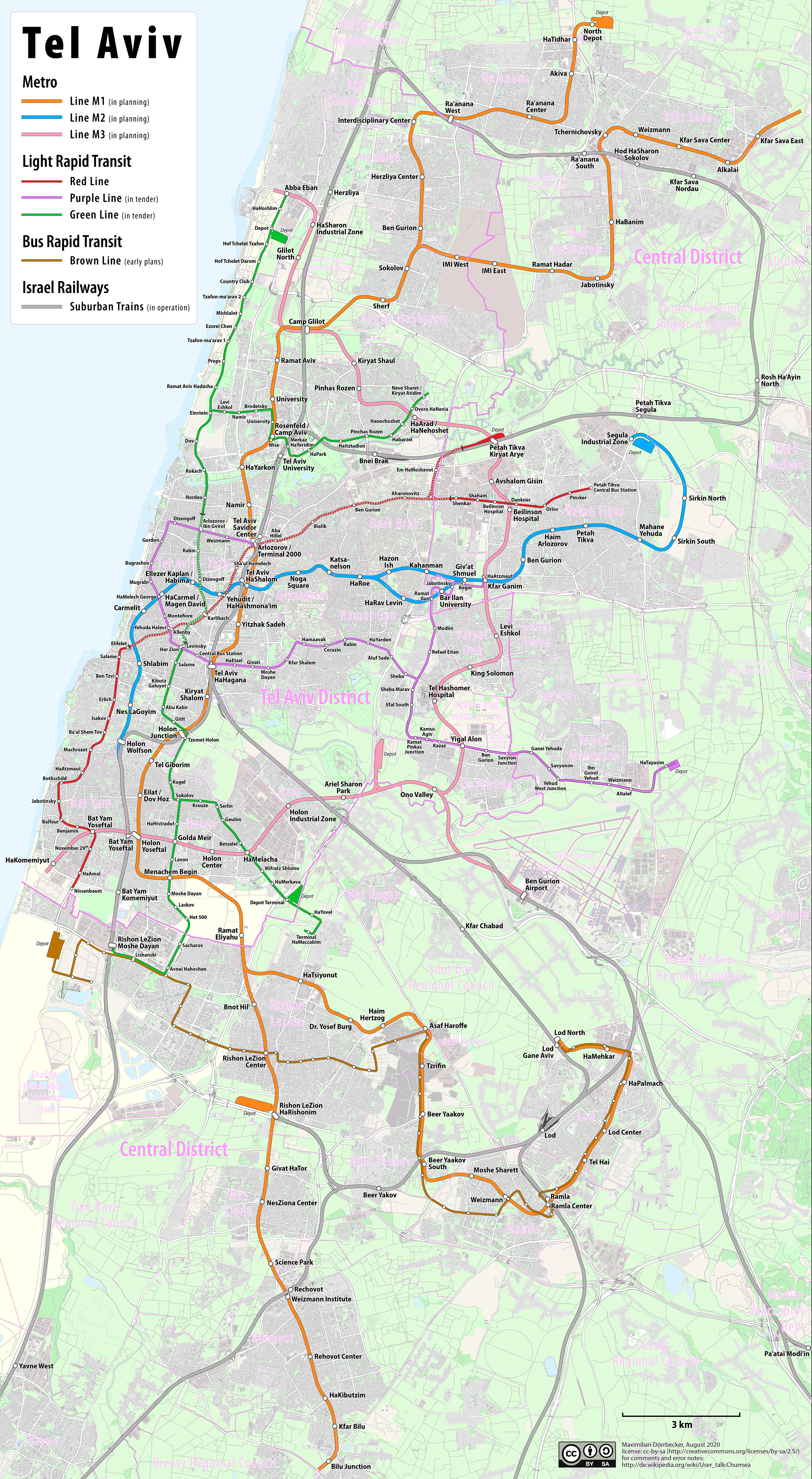
Súbor:Tel Aviv Rapid Transit Network.png
Veľkosť tohto náhľadu: 329 × 599 pixelov. Iné rozlíšenia: 132 × 240 pixelov | 263 × 480 pixelov | 422 × 768 pixelov | 562 × 1 024 pixelov | 1 125 × 2 048 pixelov | 3 500 × 6 373 pixelov .
Pôvodný súbor (3 500 × 6 373 pixelov, veľkosť súboru: 26,84 MB, MIME typ: image/png)
Zhrnutie
| Popis |
|
|||
| Dátum | see file history | |||
| Zdroj | Vlastné dielo, using OpenStreetMap data for the background | |||
| Autor | Maximilian Dörrbecker (Chumwa) | |||
| Povolenie (Využívanie tohto súboru) |
All OpenStreetMap data and maps are Creative Commons "CC-BY-SA 2.0" licensed Tento súbor podlieha licencii Creative Commons Attribution-Share Alike 2.0 Generic
|
História súboru
Po kliknutí na dátum/čas uvidíte ako súbor vyzeral vtedy.
| Dátum/Čas | Náhľad | Rozmery | Používateľ | Komentár | |
|---|---|---|---|---|---|
| aktuálna | 09:21, 19. august 2023 | | 3 500 × 6 373 (26,84 MB) | NordNordWest | Red line in operation now |
| 16:38, 18. september 2020 |  | 3 500 × 6 373 (27,79 MB) | Chumwa | == {{int:filedesc}} == {{Information |Description= *{{de|Karte: ÖPNV-Plan von Tel Aviv}} *{{en|Tel Aviv Rapid Transit Network}} *{{fr|Plan des transports public de Tel Aviv}} {{Overlay}} |Author=Maximilian Dörrbecker (Chumwa) |Source={{own}}, using OpenStreetMap data for the background |Date=see file history |Permission=All OpenStreetMap data and maps are Creative Commons "CC-BY-SA 2.0" licensed{{cc-by-sa-2.0}} |other_versions= }} [[Category:T... |
Použitie súboru
Na tento súbor odkazuje nasledujúca stránka:
Globálne využitie súborov
Nasledovné ďalšie wiki používajú tento súbor:
- Použitie na ar.wikipedia.org
- Použitie na cs.wikipedia.org
- Použitie na de.wikipedia.org
- Použitie na en.wikipedia.org
- Použitie na es.wikipedia.org
- Použitie na fa.wikipedia.org
- Použitie na fr.wikipedia.org
- Použitie na it.wikipedia.org
- Použitie na ka.wikipedia.org
- Použitie na mt.wikipedia.org
- Použitie na pl.wikipedia.org
- Použitie na pt.wikipedia.org
- Použitie na ru.wikipedia.org
- Použitie na tr.wikipedia.org
- Použitie na uk.wikipedia.org
- Použitie na www.wikidata.org
- Použitie na yi.wikipedia.org
- Použitie na zh.wikipedia.org