
Súbor:Bjornoya Location Map-en.svg

Veľkosť tohoto PNG náhľadu tohoto SVG súboru: 478 × 600 pixelov. Iné rozlíšenia: 191 × 240 pixelov | 383 × 480 pixelov | 612 × 768 pixelov | 816 × 1 024 pixelov | 1 632 × 2 048 pixelov | 1 010 × 1 267 pixelov .
Pôvodný súbor (SVG súbor, 1 010 × 1 267 pixelov, veľkosť súboru: 242 KB)
Zhrnutie
| Popis |
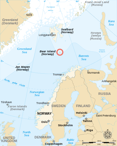
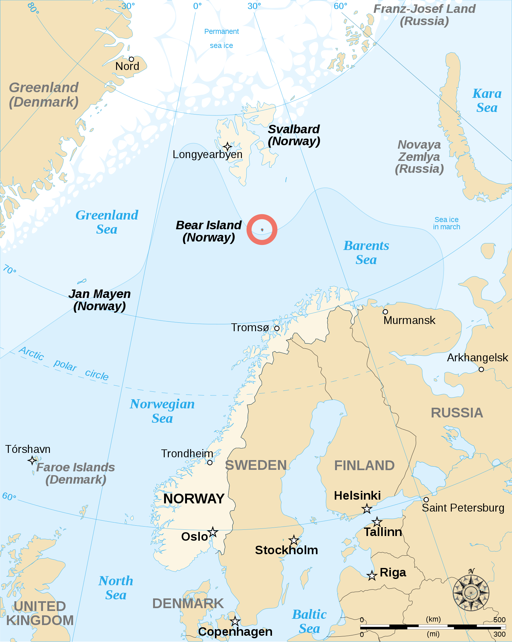
English: English map showing the location of Bear Island (Bjørnøya), a Norwegian island between Norway and Svalbard. Español: Carta en inglés con Bear Island (la isla del Oso). Français : Carte en anglais montrant l'emplacement de l'île aux Ours (Bjørnøya en norvégien), située entre la Norvège et l'archipel de Svalbard. |
||
| Dátum | |||
| Zdroj | |||
| Autor | Sémhur | ||
| Ďalšie verzie |
[]
|
||
| Uvedenie autora (vyžadované licenciou) | © Sémhur / Wikimedia Commons / | ||
| SVG | W3C-validity not checked. Táto W3C-nešpecifikovaná vektorová grafika bola vytvorená pomocou Inkscape .
|
||
| Atelier graphique |


| Pozícia kamery | | Tento a ďalšie obrázky na: OpenStreetMap |
|---|
Licencovanie
Ja, držiteľ autorských práv k tomuto dielu ho týmto zverejňujem za podmienok nasledovných licencií:
| Copyleft: Toto výtvarné dielo je slobodné; môžete ho šíriť a/alebo meniť za podmienok Free Art License. Exemplár tejto licencie nájdete na stránke Copyleft Attitude a na ďalších stránkach. |
This file is licensed under the Creative Commons Attribution-Share Alike 4.0 International, 3.0 Unported, 2.5 Generic, 2.0 Generic and 1.0 Generic license.
- Môžete slobodne:
- zdieľať – kopírovať, šíriť a prenášať dielo
- meniť ho – upravovať dielo
- Za nasledovných podmienok:
- uvedenie autorov – Musíte spomenúť autorov (jednotlivo alebo kolektívne), poskytnúť odkaz na licenciu a uviesť, či ste niečo zmenili. Môžete to urobiť ľubovoľným primeraným spôsobom, ale nie spôsobom naznačujúcim, že poskytovateľ licencie podporuje vás alebo vaše použitie diela.
- meniť za rovnakých podmienok – Ak toto dielo zmeníte, prevediete do inej formy alebo použijete ako základ iného diela, musíte výsledok šíriť pod rovnakou alebo kompatibilnou licenciou ako originál.
Môžete si zvoliť ľubovolnú z týchto licencií.
História súboru
Po kliknutí na dátum/čas uvidíte ako súbor vyzeral vtedy.
| Dátum/Čas | Náhľad | Rozmery | Používateľ | Komentár | |
|---|---|---|---|---|---|
| aktuálna | 12:48, 17. máj 2013 | | 1 010 × 1 267 (242 KB) | Sémhur | Correcting svg bugs |
| 14:00, 2. november 2007 |  | 1 010 × 1 267 (242 KB) | Sémhur | {{Information| Description= {{en}}English map showing the location of Bjørnøya (''Bear Island'' in English), an island between Norway and Svalbard. {{fr}}Carte en anglais montrant la localisation de l'île aux Ours (''Bjørnøya'' en Norvégien), situ� |
Použitie súboru
Na tento súbor odkazuje nasledujúca stránka:
Globálne využitie súborov
Nasledovné ďalšie wiki používajú tento súbor:
- Použitie na ar.wikipedia.org
- Použitie na br.wikipedia.org
- Použitie na de.wikipedia.org
- Použitie na en.wikipedia.org
- Použitie na es.wikipedia.org
- Použitie na fa.wikipedia.org
- Použitie na fo.wikipedia.org
- Použitie na fy.wikipedia.org
- Použitie na gl.wikipedia.org
- Použitie na hr.wikipedia.org
- Použitie na li.wikipedia.org
- Použitie na nl.wikipedia.org
- Použitie na nn.wikipedia.org
- Použitie na sl.wikipedia.org
- Použitie na sr.wikipedia.org
- Použitie na sv.wikipedia.org
- Použitie na sw.wikipedia.org
- Použitie na uk.wikipedia.org
- Použitie na ur.wikipedia.org